
10.5: Southeast Asia- Introducing the Realm (1 Day)
- Page ID
- 1977
- Understand the geographical differences between the mainland region and the insular region.
- Summarize how the region was colonized. Learn how colonial activities influence each country’s cultural situation.
- Realize how the physical geography has been influenced by tectonic activity.
- Outline the main ethnic and religious affiliations of Southeast Asia and explain why they are so diverse.
- Comprehend the impact and influence of the overseas Chinese in the region.
TEKS Regional Unit 10 East and Southeast Asia: Chapter 10.5 Southeast Asia-Introducing the Realm
WG.1A Analyze the effects of physical and human geographic patterns and processes on the past and describe their impact on the present, including significant physical features and environmental conditions that influenced migration patterns and shaped the distribution of culture groups today.
WG.3B Describe the physical processes that affect the environments of regions, including weather, tectonic forces, erosion, and soil-building processes.
WG.3C Examine the physical processes that affect the lithosphere, atmosphere, hydrosphere, and biosphere. Examine the physical processes that affect the lithosphere, atmosphere, hydrosphere, and biosphere.
WG.4A Explain how elevation, latitude, wind systems, ocean currents, position on a continent, and temperature, precipitation, and distribution of climate regions.
WG.4C Explain the influence of climate on the distribution of biomes in different regions.
WG.8A Compare ways that humans depend on, adapt to, and modify the physical environment, including the influences of culture and technology.
WG.10D Compare global trade patterns over time and examine the implications of globalization, including outsourcing and free trade zones.
WG.22D Use geographic terminology correctly.
WG.22D Use standard grammar, spelling, sentence structure, and punctuation.
Southeast Asia: Introducing the Realm
Physical Geography of Southeast Asia
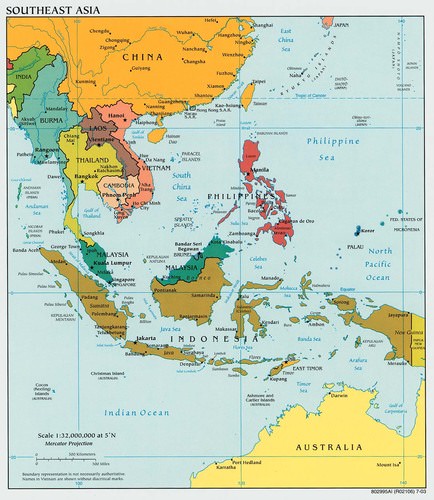 Map of Southeast Asia
The islands and the mainland of Southeast Asia include a wide array of physical and cultural landscapes. The entire realm is located in the tropics except the northernmost region of Myanmar, which extends north of the Tropic of Cancer. A tropical type A climate dominates the region and rainfall is generally abundant. The tropical waters of the region help moderate the climate.
Southeast Asia is located between the Indian Ocean on the west and the Pacific Ocean on the east. Bordering the many islands and peninsulas are various seas, bays, straits, and gulfs that help create the complex maritime boundaries of the realm. The South China Sea is a major body of water that acts as a separator between the mainland and the insular region. The thousands of islands that make up the various countries or lie along their coastal waters create a matrix of passageways and unique physical geography.
The three longest rivers of the realm, Mekong, Red, and Irrawaddy, are located on the mainland and have their headwaters in the high elevations of Himalayan ranges of China. The Mekong River makes its way from the high Himalayas in China and helps form the political borders of Laos and Thailand on its way through Cambodia to Vietnam where it creates a giant delta near Ho Chi Minh City (Saigon).
The Red River flows out of China and through Hanoi to the Red River delta on the Gulf of Tonkin. The Irrawaddy River flows through the length of Burma providing for the core area of the country. Another major river of the mainland is the Chao Phraya of Thailand. With its many tributaries, the Chao Phraya creates a favorable core area that is home to the largest population of the country.
Many other rivers can be found on both the mainland and the insular region. The rivers transport water and sediments from the interior to the coasts, often creating large deltas with rich soils that are major agricultural areas. Multiple crops of rice and food products can be grown in the fertile river valleys and deltas. The agricultural abundance is needed to support the ever-increasing populations of the realm.
Tectonic plate activity has been responsible for the existence of the many islands and has created the mountainous terrain of the various countries. High mountain ranges can have peaks that reach elevations of over 15,000 feet. The high-elevation ranges of New Guinea, which are along the equator, actually have glaciers, ice, and snow that remain year-round.
The island of Borneo, in the center of the insular region, is a segment of ancient rock that has been pushed upward by tectonic forces to form a mountainous land mass. The mountains on Borneo have been worn down over time by erosion. Mountains and highlands stretch across the northern border of the realm along the borders with India and China. The interior nature of this border makes it less accessible.
Similar dynamics can be found in the interior of the islands of the insular region, where the isolation and remoteness have helped create the environmental conditions for unique flora and fauna. In the highland areas the human cultural landscape can be diverse. Time and isolation have worked together to form the traditions and cultural ways that give local groups their identity and heritage.
Tectonic activity makes the region vulnerable to earthquakes and volcanic eruptions. The volcanic peak of Mount Pinatubo, in the Philippines, erupted in 1991, spewing ash and smoke into the atmosphere and impacting much of the planet. An earthquake of 9.0 magnitude occurred off the coast of the Indonesian island of Sumatra in 2004 and caused widespread disaster throughout the wider region of the Indian Ocean. As many as one 150,000 deaths were reported, mainly from flooding. A 35-foot-high wall of water from the tsunami devastated many coastal areas from Thailand to India.
Impact of Colonialism
Southeast Asia has not escaped the impact of globalization, both colonial and corporate. As Europeans expanded their colonial activities, they made their way into Southeast Asia. Southeast Asia was heavily influenced by European colonialism. The only area of the region that was not colonized by the Europeans was Thailand, which was called Siam during the colonial era. It remained an independent kingdom throughout the colonial period and was a buffer state between French and British colonizers. The Japanese colonial empire controlled much of Southeast Asia before World War II.
Some of the countries and regions of Southeast Asia became known by their colonial connection. Indonesia was once referred to as the Dutch East Indies, which was influential in the labeling of the Caribbean as the West Indies. French Indochina is a term legitimized for historical references to the former French claims in Southeast Asia. Malaya and British Borneo each had its own currency based on a dollar unit that was legal tender for the regions of the Federation of Malaya, Singapore, Sarawak, North Borneo, and Brunei.
Independence from the European powers and freedom from Japanese imperialism by the end of World War II provided a new identification for the various countries of the realm. Cultural and economic ties remain between many former colonies and their European counterparts.
East Timor, a former Portuguese colony south of Indonesia, has been the most recent colony to gain independence. Timor is an island just north of Australia. The western portion is claimed by Indonesia. The whole island was annexed to Indonesia in 1975. As a result of separatist movements that entailed conflict and violence, the eastern portion was finally granted independence in 2002. Since then, East Timor has been working to establish itself as a country and is now negotiating its offshore boundary to include important oil and gas reserves.
Cultural Introduction
Southeast Asia has a population of more than 600 million people. More than half of the population lives on the many islands of Indonesia and the Philippines. The small island of Java in Indonesia is one of the most densely populated places on Earth. More than half of the more than 260 million people who live in Indonesia live on the island of Java. The island of Luzon in the Philippines is also one of the more densely populated areas of the insular region.
The Philippines has over 104 million Filipino people, Vietnam has more than 96 million, and Thailand has more than 68 million. Local areas with high food-producing capacity are also high population centers, which would include deltas, river valleys, and fertile plains.
The ethnic mosaic of Southeast Asia is a result of the emergence of local differences between people who have evolved into identifiable cultural or ethnic groups. Though there are a multitude of specific ethnic groups, a number of the larger ones stand out with recognizable populations. On the mainland the Burmese, Thai, Khmer, and Vietnamese are the largest groups, coinciding with the physical countries from Burma to Vietnam.
A similar situation can be found in the insular region. Many distinct groups can exist on the many islands of the region. The island of New Guinea, for example, has hundreds of local groups with their own languages and traditions. The large number of ethnic groups is dominated by Indonesians, Malays, and Filipinos, coinciding with the countries of Indonesia, Malaysia, and the Philippines.
Each of these main groups has many subgroups that hold to their own cultural heritage in the areas where they exist. The many islands of Indonesia and the Philippines create the opportunity for diversity to continue to thrive, in spite of the globalization process that increased the interaction and communication opportunities between groups.
Indonesia is also home to the largest Muslim population in the world. All major religions can be found here. The Philippine population is predominantly Christian, but there is a minority Muslim community, including rebel insurgents. Most of people in Malaysia follow Islam. About 95 percent of the people in Thailand and more than 60 percent of the people in Laos are Buddhist. Hinduism is present in the Indonesian island of Bali and in various other locations in the region. Animism and local religions can be found in rural and remote areas. Southeast Asia is a mix of many ethnic groups, each with its own history, culture, and religious preference.
| Country | Religions |
|---|---|
|
|
Hinduism (69%), Christianity, Islam, Sikhism and others |
|
|
Islam (67%), Buddhism, Christianity, others (indigenous beliefs, etc.) |
|
|
Buddhism (89%), Islam, Christianity, Hinduism, Animism, others |
|
|
Buddhism (97%), Islam, Christianity, Animism, others |
|
|
Buddhism (75%), Islam, Christianity |
|
|
Islam (80%), others |
|
|
Roman Catholicism (97%), Protestantism, Islam, Hinduism, Buddhism |
|
|
Islam (87.18%), Protestantism, Roman Catholicism, Hinduism, Buddhism, Confucianism, others |
|
|
Buddhism (67%), Animism, Christianity, others |
|
|
Islam (60.4%), Buddhism, Christianity, Hinduism, Animism |
|
|
Roman Catholicism (80%), Islam (11%), Iglesia ni Cristo (Church of Christ) (3%), Buddhism (2%), Animism (1.25%), others (0.35%) |
|
|
Buddhism, Christianity, Islam, Taoism, Hinduism, others |
|
|
Buddhism (93.83%), Islam (4.56%), Christianity (0.8%), Hinduism (0.011%), others (0.079%) |
|
|
Vietnamese folk religion (45.3%), Buddhism (16.4%), Christianity (8.2%), Other (0.4%), Unaffiliated (29.6%) |


Overseas Chinese
Southeast Asia is also home to over 30 million overseas Chinese—ethnic Chinese who live outside of China. The Chinese exodus to the realm was the greatest during the last Chinese dynasties and during the colonial era. European colonial powers enhanced this migration pattern by leveraging the use of people with Chinese heritage in their governing over the local populations in the realm.
Life has often been difficult for overseas Chinese. The Japanese occupation of the realm during World War II was a time of harsh discrimination against Chinese. Japanese occupation and colonialism diminished with the end of World War II. The overseas Chinese minority retained an economic advantage because of their former colonial status and their economic connections.
Chinatowns emerged in many of the major cities of Southeast Asia. The discrimination against the Chinese, fueled by religious or socioeconomic differences, often continued after World War II by the local ethnic majorities. Nevertheless, overseas Chinese in Southeast Asia have been instrumental in promoting the global business arrangements that have established the Pacific Rim as a major player in the international economy.
| Country | Currency | Population (2017) | Main industries |
|---|---|---|---|
|
|
B$ Brunei dollar | 443,593 | Petroleum, Petrochemicals, Fishing |
|
|
៛ Riel | 16,204,486 | Clothing, Gold, Agriculture |
|
|
US$ US dollar | 1,291,358 | Petroleum, Coffee, Electronics |
|
|
IDR Rupiah | 260,580,739 | Coal, Petroleum, Palm oil |
|
|
₭ Kip | 7,126,706 | Copper, Electronics, Tin |
|
|
RM Ringgit | 31,381,992 | Electronics, Petroleum, Palm oil |
|
|
K Kyat | 55,123,814 | Natural gas, Agriculture, Clothing |
|
|
₱ Weight | 104,256,076 | Electronics, Timber, Automotive |
|
|
S$ Singapore dollar | 5,888,926 | Electronics, Petroleum, Chemicals |
|
|
฿ Baht | 68,414,135 | Electronics, Automotive, Rubber |
|
|
₫ Dong | 96,160,163 | Electronics, Clothing, Agriculture |
- Southeast Asia can be studied by dividing up the realm into two geographic regions: the mainland and the insular region. The mainland borders China and India and has extensive river systems. The insular region is made up of islands and peninsulas between Asia and Australia, often with mountainous interiors.
- France and Britain colonized the mainland region of Southeast Asia. Burma was a British colony and the rest was under French colonial rule. The Japanese took control of the region briefly before World War II ended in 1945. Siam was the only area not colonized. Siam became the country of Thailand.
- The physical geography of the mainland and the insular region is dominated by a tropical type A climate. Cooler temperatures may be found in the mountainous regions and more even temperatures ranges can be found along the coasts. Tectonic plate activity is responsible for the many earthquakes and volcanic eruptions that occur in the realm.
- Southeast Asia is ethnically, religiously, and linguistically diverse. A number of major ethnic groups dominate in the mainland and insular region but are only examples of the multitude of smaller groups that exist in the realm. One minority group is the overseas Chinese, who immigrated to the realm during the colonial era.
Vocabulary Terms
|
A set of closely grouped islands. |
|
|
A French colony in Southeast Asia comprised of Cambodia, Laos, and Vietnam. |
|
|
A powerful empire that lasted roughly from the 9th to 15th centuries in what is now Cambodia. |
|
|
A major river that runs south from southern China through Laos, Cambodia, and Vietnam. |
|
|
The former name of Thailand. |
|
|
The Vietnamese New Year and most important holiday in Vietnam. |
|
|
The region is located in the low latitudes and characterized by warm temperatures year round and abundant rainfall. Within the tropical climate region are the sub regions of tropical rainforest and savanna |
|
|
Found in tropical areas near the equator where the climate is characterized by plentiful rainfall and warm year round temperatures. This biome is home to a great variety of plant and animal life. |
Applying Knowledge
Discussion and Study Questions
- Which countries of Southeast Asia are in the mainland region? Which countries are in the insular region?
- What are the four main rivers of the mainland region and how do they contribute to each region’s economic activities?
- How has tectonic plate activity been evident in Southeast Asia? How has the rest of the world been influenced by tectonic activity in the realm?
- Which European countries have been the main colonizers and which countries did each colonize? How has the colonial experience influenced the realm?
- Where are the main population centers? Why are these locations favorable to such large populations? Which countries are the most populous?
- What are the main ethnic groups on the mainland and in the insular region? Why are there so many ethnic groups in this realm? How has physical geography contributed to the diversity?
- What are the main religious affiliations of the realm? Which countries have the largest Buddhist, Muslim, and Christian populations? How do you think this diversity of religious beliefs could create difficulties in the workplace?
- What is the newest country to declare independence in the realm? Which European country colonized the area? Why didn’t this country gain its independence many decades ago?
- How have the overseas Chinese influenced the realm of Southeast Asia? Why have the overseas Chinese been so influential in the economic situation of the Pacific Rim?
- What other region of the world has similar dynamics in physical geography and colonial activities to the insular region of Southeast Asia?
Real-World Geography Exercise
Go to Real-Time World Air Quality Index. Choose five of the locations below and find the current air quality index. Which areas have the best air quality? Which areas have the worst air quality? How does the air quality impact the quality of life for people in each region? Be prepared to share your answers.
- Chao Phraya River
- Gulf of Tonkin
- Ho Chi Minh City
- Indochina
- Insular Region
- Irrawaddy River
- Mainland Region
- Mekong River
- Red River
- Saigon
Helpful Websites for the Study of Geography
Canadian Encyclopedia is an encyclopedia funded by the Canadian government covering all branches of knowledge. Their scholarly collection includes interactive materials.
CIA World Factbook provides information on the people, history, government, economy, energy, geography, communications, transportation, military, and transnational issues for the world's entities.
Congress.gov is a US government website where you can find federal legislation, past and present, as well as information about the US legal system.
Drug Enforcement Administration (DEA) is a government agency website that provides current news, resources, topics of interest, information about drugs, careers in the DEA, and a tip hotline.
Library of Congress is the largest library in the world and provides manuscripts, files, information, pictures, and videos.
NASA Earth Observatory (NEO) is a US government agency website that allows users to search for and retrieve satellite images of Earth.
National Archives is a US government website that provides historical documents, photos, records, publications, and educator resources.
National Oceanic and Atmospheric Association (NOAA) is a US government agency website that provides weather-related information and ocean research.
National Map is a website by the United States Geological Survey and other federal, state, and local agencies that delivers topographic information for the United States.
NationMaster is a massive central data source and a handy way to graphically compare nations.
Real-Time World Air Quality Index is a website that measures most locations in the world for air pollution in real time.
StateMaster is a unique statistical database which allows you to research and compare a multitude of different data on US states.
United Nations (UN) is an international organization founded in 1945 and made up of 193 member states. The UN maintains international peace and security, protects human rights, delivers humanitarian aid, promotes sustainable development, and upholds international law.
United States Census Bureau is a US government agency that provides a population clock, data, surveys, statistics, a library with information and infographics, news about the economy, and much more.
United States Geological Survey (USGS) is a US government agency website that provides scientific information about the natural hazards that threaten lives, the natural resources we rely on, the health of our ecosystems and environment, and the impacts of climate and land-use change.
Whitehouse.gov is a US government website that provides the latest presidential news, information about the budget, policy, defense, and many more topics.
World Health Organization (WHO) is under the United Nations and provides leadership on matters critical to health; shapes the research agenda on health; and monitors the health situation and assessing health trends around the world. Their website provides information on the state of health around the world, outbreaks, current health news, and more.
World Trade Organization (WTO) is an intergovernmental organization that regulates international trade. The website provides information on the history of the multilateral trading system, featured videos, news and events, trade topics, and more.
| Image | Reference | Attributions |
|
[Figure 1] | Credit: Updated from map courtesy of University of Texas Libraries. Source: https://legacy.lib.utexas.edu/maps/middle_east_and_asia/southeast_asia_pol_2003.jpg License: CC BY-NC 3.0 |