8.4: West Africa (2 Days)
- Page ID
- 1967
\( \newcommand{\vecs}[1]{\overset { \scriptstyle \rightharpoonup} {\mathbf{#1}} } \)
\( \newcommand{\vecd}[1]{\overset{-\!-\!\rightharpoonup}{\vphantom{a}\smash {#1}}} \)
\( \newcommand{\dsum}{\displaystyle\sum\limits} \)
\( \newcommand{\dint}{\displaystyle\int\limits} \)
\( \newcommand{\dlim}{\displaystyle\lim\limits} \)
\( \newcommand{\id}{\mathrm{id}}\) \( \newcommand{\Span}{\mathrm{span}}\)
( \newcommand{\kernel}{\mathrm{null}\,}\) \( \newcommand{\range}{\mathrm{range}\,}\)
\( \newcommand{\RealPart}{\mathrm{Re}}\) \( \newcommand{\ImaginaryPart}{\mathrm{Im}}\)
\( \newcommand{\Argument}{\mathrm{Arg}}\) \( \newcommand{\norm}[1]{\| #1 \|}\)
\( \newcommand{\inner}[2]{\langle #1, #2 \rangle}\)
\( \newcommand{\Span}{\mathrm{span}}\)
\( \newcommand{\id}{\mathrm{id}}\)
\( \newcommand{\Span}{\mathrm{span}}\)
\( \newcommand{\kernel}{\mathrm{null}\,}\)
\( \newcommand{\range}{\mathrm{range}\,}\)
\( \newcommand{\RealPart}{\mathrm{Re}}\)
\( \newcommand{\ImaginaryPart}{\mathrm{Im}}\)
\( \newcommand{\Argument}{\mathrm{Arg}}\)
\( \newcommand{\norm}[1]{\| #1 \|}\)
\( \newcommand{\inner}[2]{\langle #1, #2 \rangle}\)
\( \newcommand{\Span}{\mathrm{span}}\) \( \newcommand{\AA}{\unicode[.8,0]{x212B}}\)
\( \newcommand{\vectorA}[1]{\vec{#1}} % arrow\)
\( \newcommand{\vectorAt}[1]{\vec{\text{#1}}} % arrow\)
\( \newcommand{\vectorB}[1]{\overset { \scriptstyle \rightharpoonup} {\mathbf{#1}} } \)
\( \newcommand{\vectorC}[1]{\textbf{#1}} \)
\( \newcommand{\vectorD}[1]{\overrightarrow{#1}} \)
\( \newcommand{\vectorDt}[1]{\overrightarrow{\text{#1}}} \)
\( \newcommand{\vectE}[1]{\overset{-\!-\!\rightharpoonup}{\vphantom{a}\smash{\mathbf {#1}}}} \)
\( \newcommand{\vecs}[1]{\overset { \scriptstyle \rightharpoonup} {\mathbf{#1}} } \)
\(\newcommand{\longvect}{\overrightarrow}\)
\( \newcommand{\vecd}[1]{\overset{-\!-\!\rightharpoonup}{\vphantom{a}\smash {#1}}} \)
\(\newcommand{\avec}{\mathbf a}\) \(\newcommand{\bvec}{\mathbf b}\) \(\newcommand{\cvec}{\mathbf c}\) \(\newcommand{\dvec}{\mathbf d}\) \(\newcommand{\dtil}{\widetilde{\mathbf d}}\) \(\newcommand{\evec}{\mathbf e}\) \(\newcommand{\fvec}{\mathbf f}\) \(\newcommand{\nvec}{\mathbf n}\) \(\newcommand{\pvec}{\mathbf p}\) \(\newcommand{\qvec}{\mathbf q}\) \(\newcommand{\svec}{\mathbf s}\) \(\newcommand{\tvec}{\mathbf t}\) \(\newcommand{\uvec}{\mathbf u}\) \(\newcommand{\vvec}{\mathbf v}\) \(\newcommand{\wvec}{\mathbf w}\) \(\newcommand{\xvec}{\mathbf x}\) \(\newcommand{\yvec}{\mathbf y}\) \(\newcommand{\zvec}{\mathbf z}\) \(\newcommand{\rvec}{\mathbf r}\) \(\newcommand{\mvec}{\mathbf m}\) \(\newcommand{\zerovec}{\mathbf 0}\) \(\newcommand{\onevec}{\mathbf 1}\) \(\newcommand{\real}{\mathbb R}\) \(\newcommand{\twovec}[2]{\left[\begin{array}{r}#1 \\ #2 \end{array}\right]}\) \(\newcommand{\ctwovec}[2]{\left[\begin{array}{c}#1 \\ #2 \end{array}\right]}\) \(\newcommand{\threevec}[3]{\left[\begin{array}{r}#1 \\ #2 \\ #3 \end{array}\right]}\) \(\newcommand{\cthreevec}[3]{\left[\begin{array}{c}#1 \\ #2 \\ #3 \end{array}\right]}\) \(\newcommand{\fourvec}[4]{\left[\begin{array}{r}#1 \\ #2 \\ #3 \\ #4 \end{array}\right]}\) \(\newcommand{\cfourvec}[4]{\left[\begin{array}{c}#1 \\ #2 \\ #3 \\ #4 \end{array}\right]}\) \(\newcommand{\fivevec}[5]{\left[\begin{array}{r}#1 \\ #2 \\ #3 \\ #4 \\ #5 \\ \end{array}\right]}\) \(\newcommand{\cfivevec}[5]{\left[\begin{array}{c}#1 \\ #2 \\ #3 \\ #4 \\ #5 \\ \end{array}\right]}\) \(\newcommand{\mattwo}[4]{\left[\begin{array}{rr}#1 \amp #2 \\ #3 \amp #4 \\ \end{array}\right]}\) \(\newcommand{\laspan}[1]{\text{Span}\{#1\}}\) \(\newcommand{\bcal}{\cal B}\) \(\newcommand{\ccal}{\cal C}\) \(\newcommand{\scal}{\cal S}\) \(\newcommand{\wcal}{\cal W}\) \(\newcommand{\ecal}{\cal E}\) \(\newcommand{\coords}[2]{\left\{#1\right\}_{#2}}\) \(\newcommand{\gray}[1]{\color{gray}{#1}}\) \(\newcommand{\lgray}[1]{\color{lightgray}{#1}}\) \(\newcommand{\rank}{\operatorname{rank}}\) \(\newcommand{\row}{\text{Row}}\) \(\newcommand{\col}{\text{Col}}\) \(\renewcommand{\row}{\text{Row}}\) \(\newcommand{\nul}{\text{Nul}}\) \(\newcommand{\var}{\text{Var}}\) \(\newcommand{\corr}{\text{corr}}\) \(\newcommand{\len}[1]{\left|#1\right|}\) \(\newcommand{\bbar}{\overline{\bvec}}\) \(\newcommand{\bhat}{\widehat{\bvec}}\) \(\newcommand{\bperp}{\bvec^\perp}\) \(\newcommand{\xhat}{\widehat{\xvec}}\) \(\newcommand{\vhat}{\widehat{\vvec}}\) \(\newcommand{\uhat}{\widehat{\uvec}}\) \(\newcommand{\what}{\widehat{\wvec}}\) \(\newcommand{\Sighat}{\widehat{\Sigma}}\) \(\newcommand{\lt}{<}\) \(\newcommand{\gt}{>}\) \(\newcommand{\amp}{&}\) \(\definecolor{fillinmathshade}{gray}{0.9}\)- Summarize the main geographic aspects of each country in West Africa.
- Understand each country’s development pattern and their current political situation.
- Explain how family size and economic activities are related to population growth.
- Outline the main economic activities of each country and how they are related to natural resources.
TEKS Regional Unit 08: Africa Chapter 8.4 West Africa
WG.1B Describe the human and physical characteristics of the same regions at different periods of time to evaluate relationships between past events and current conditions.
WG.5A Analyze how the character of a place is related to its political, economic, social, and cultural elements.
WG.5B Interpret political, economic, social, and demographic indicators (gross domestic product per capita, life expectancy, literacy, and infant mortality) to determine the level of development and standard of living in nations using the terms Human Development Index, less developed, newly industrialized, and more developed.
WG.7DExamine benefits and challenges of globalization, including connectivity, standard of living, pandemics, and loss of local culture.
WG.9A Identify physical and/or human factors such as climate, vegetation, language, trade networks, political units, river systems, and religion that constitute a region.
WG.9B Describe different types of regions, including formal, functional, and perceptual regions.
WG.11B Identify the factors affecting the location of different types of economic activities, including subsistence and commercial agriculture, manufacturing, and service industries.
WG.12B Analyze how the creation, distribution, and management of key natural resources affects the location and patterns of movement of products, money, and people.
WG.13A Interpret maps to explain the division of land, including man-made and natural borders, into separate political units such as cities, states, or countries.
WG.14C Analyze current events to infer the physical and human processes that lead to the formation of boundaries and other political divisions.
WG.16B Describe elements of culture, including language, religion, beliefs and customs, institutions, and technologies.
WG.18C Identify examples of cultures that maintain traditional ways, including traditional economies.
WG.22D Use standard grammar, spelling, sentence structure, and punctuation.
WG.22E Create original work using proper citations and understanding and avoiding plagiarism.
TEKS and ELPS for Regional World Geography Unit 08--Africa from TEKS Resource System.
West Africa
The region of West Africa includes the southern portion of the bulge of the continent, which extends westward to the Atlantic Ocean. This region is bisected by the African Transition Zone, which borders the southern edge of the Sahara Desert. The main physical features include the Sahara Desert and the Niger River. The Cameroon Highlands are located on the eastern border between Nigeria and Cameroon. At 4,100 miles long, the Nile River is the longest, while the Congo River is Africa’s second longest at 2,922 miles in length. The Niger River is Africa’s 3rd-longest river and extends more than 2,600 miles from the Guinea Highlands through Mali, Niger, and Nigeria before reaching the Atlantic Ocean in the Gulf of Guinea.
Some geographers include the country of Chad or portions of it within the region of West Africa. In this textbook, Chad is listed with Central Africa. The portions of Chad located north of the African Transition Zone share similar characteristics with North Africa. Off the coast of Mauritania are the Cape Verde Islands, which are united as an independent country associated with Africa. Cape Verde was once a Portuguese colony but received its independence in 1975. Western Sahara has been in conflict with Morocco over independence and is most often associated with the region of North Africa because of the influence of Islam and because of its connection to Morocco.
The African Transition Zone cuts across the region of West Africa, indicating a division between Islam and Christianity and between the Sahara Desert and the tropics. This diversity in religion and climate is usually exhibited with a north/south division. Islam is the dominant religion on the north side of the African Transition Zone. Christianity is more dominant to the south. The two religions often clash in the areas where they meet. Traditional beliefs and animist religions are also practiced in the African Transition Zone.
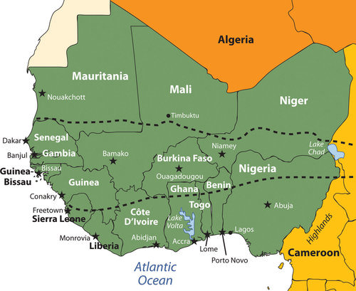 This map shows the region of West Africa as defined in this chapter. The African Transition Zone crosses the middle of this region.
The terms “state” and “country” are often used interchangeably by the world community outside of the United States. Both are meant to refer to a physical unit with a sovereign and independent government. In Sub-Saharan Africa the term “state” is commonly used to refer to a country in any one of the various regions.
Niger
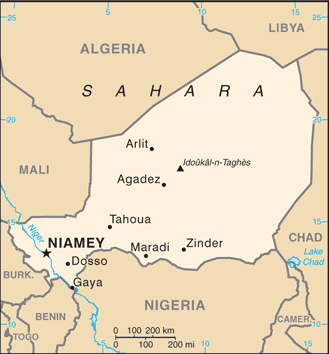 Map of Niger
The former French colony of Niger is landlocked, with the Sahara Desert making up its largest portion. Niger is a land of subsistence farmers, and most of the population lives in the southern regions. The country is less than 20 percent urban. Other economic activities include uranium mining, which is the country’s main export. The world demand for uranium has not been strong in recent years. Oil exploration has begun and international oil corporations have garnered contracts for drilling.
The Sahara Desert is moving southward, and the agrarian culture at the base of Niger’s society is often plagued by drought and famine. The Niger River flows through the southwestern region and provides fresh water, but the northern region is mainly the Sahara Desert, and large portions are covered with sand dunes.
The country has extreme demographics. Niger has the highest fertility rate in the world, and half the population is under the age of 15, causing a population explosion that taxes the sparse natural resources and brings even more poverty to a country at the bottom end of the index of economic development. Infant mortality rates in Niger have been the highest in the world.
The mainly Sunni Muslim country has a rich cultural base but suffers from economic problems that appear to increase with the increase in population and desertification. Heavy national debt has hindered social services and has required a considerable amount of foreign aid from a number of sources. France has been a main contributor of providing economic aid along with the United Nations (UN).
The political conditions in Niger are typical of the region. For the first 30 years after independence from France, the country was ruled by a single political party and military rule. There have been several coups and various political leaders have been in power. A dispute remains with Libya over its northern border. Ethnic infighting with a minority Tuareg group has emerged in recent years, bringing conflict and discord.
The Tuareg, found throughout northwest Africa in the interior Saharan region, have many ethnic clans and have been masters of camel caravans, often with a nomadic heritage. Their clothing is often made of cloth colored with an indigo dye that distinguishes them from other ethnic groups. The Tuareg fought historic battles for an independent homeland against the French during the colonial era.
Mali
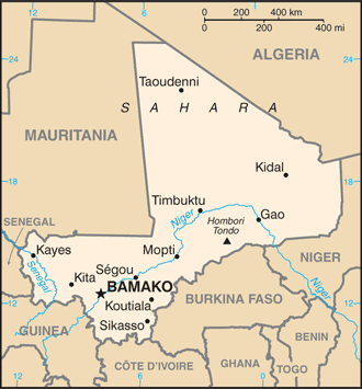 Map of Mali
To the west of Niger is Mali, another landlocked Muslim country dominated by the Sahara Desert. Mali was home to ancient empires. Wealth was historically gained from the mining of gold, salt, and copper. The Niger River flows through the entire southern region, providing a means of transportation and fishing as well as fresh water. The ancient city of Timbuktu, once a port on the Niger River, was a center of commerce and trade for the region and was used by the Tuareg as early as the 10th century.
Timbuktu has played an important role as an educational focal point for many of the peoples of the region. The University of Timbuktu is noted for its educational activities, colleges and madrasas (Islamic schools of learning). At one point in its history, it claimed to hold the largest collection of books in Africa. The capital city of Mali is not Timbuktu but Bamako, which is located in the southwest. Timbuktu remains a main tourist destination for the country and the region.
Mali shares similar political dynamics and demographics with Niger and the rest of the region. However, Mali now has a stable democratic government with little political conflict. There are issues with the Tuareg in the north and refugees from Ivory Coast in the south, but the country is politically stable in spite of the low standard of living and high population growth.
Mauritania
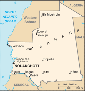 Map of Mauritania
Mauritania is also dominated by Islam and the Sahara Desert. Niger, Mali, and Mauritania are the largest of the West African states and together would cover the area of the United States east of the Mississippi River. The term “state” refers to countries with independent governments. Mauritania’s access to the Atlantic coast provides a shipping connection to the rest of the world. For years, the country fought over control of portions of Western Sahara but gave up those areas in 1975.
Unfortunately, the political and economic problems that are common in the region are evident in Mauritania. In 1960, the country gained its independence from the French, and a number of political coups and changes in government occurred as a result. Inter-ethnic conflicts exist between the African groups of the south and the Arab-Berber groups of the north.
Political unrest and economic hardships continue to add to the challenge of a growing population. Poverty, health care, and education have been major issues that require government support. Foreign aid has been critical to the operation of the country.
Large amounts of iron ore make up about 40 percent of the country’s exports. Fishing off of the coast has great potential but has been exploited by international fishing vessels. Thus, Mauritania is in danger of losing revenues and a declining resource base if protection is not secured. Even though the country is largely desert, most of the population works in subsistence agriculture.
Within certain communities in Mauritania, especially within the Arab Moor group, the concept of female beauty and prosperity was often associated with ample body size. Young girls were encouraged to eat high-fat foods in high quantities and at times were force-fed to put on weight. Being fat was an indication of wealth, and being thin was a sign of poverty and low self-esteem. This custom resulted in many women being considered overweight and obese by today’s health standards. This trend is not as common today, though it still exists. Many Mauritanian women consider this old-fashioned, and natural eating habits are more the standard. Global views regarding women might be contributing to the country’s current concept of beauty and health.
Senegal and the Gambia
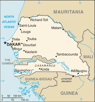 Map of Senegal
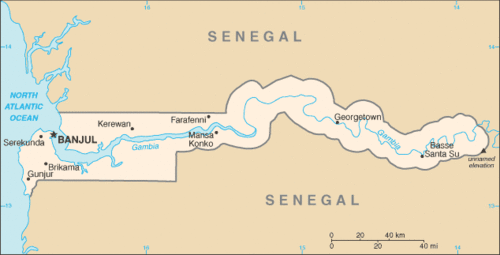 Map of the Gambia
The country of Senegal on the Atlantic coast totally surrounds the independent country of the Gambia. Senegal was a French colony, while the Gambia was a British colony. The Gambia is an enclave of Senegal and extends on both sides of the Gambia River for about 186 miles. It is the smallest country on the mainland of Africa and is about the size of the US state of Connecticut. The two countries of Senegal and the Gambia were united into the confederation of Senegambia from 1982 to 1989 when it was dissolved. They have kept separate political identities ever since.
The capital of Senegal, Dakar, is located on the Cap-Vert Peninsula, which is the most extreme western extension of the African continent. Dakar was a main colonial port for French West Africa during colonial times. The French influence remains. The common currency in what were former French colonies is the West African Central African franc, which has a fixed rate in relation to the euro.
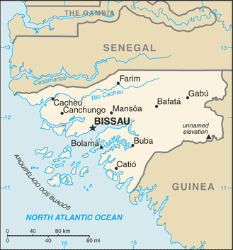
Guinea and Guinea-Bissau
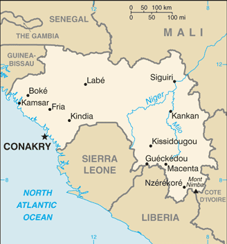 Map of Guinea
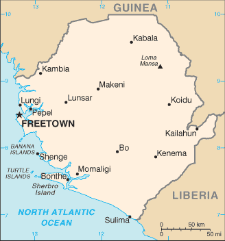
Map of Guinea-Bissau
Freeing itself from the grip of Portuguese colonial rule was a hard-fought battle for Guinea-Bissau, which became independent in 1974. The political upheaval that followed up to the present has resulted in various coups, military rule, changes in leadership, and the assassination of their president in 2009. Without political stability, it is difficult to develop a growing economy. Graft, corruption, and civil war have devastated the country’s infrastructure and hindered its economic development, making it among the poorest nations in the world. The country has to depend on outside aid to supply its basic needs.
The French colony of Guinea, which is larger than Guinea-Bissau, holds more promise due to its generous natural resource base, but Guinea has suffered the same types of political and economic disasters as its smaller neighbor. Though mineral resources are abundant, there is potential for increased agricultural production, where most of the people make their living. Guinea has a large amount of bauxite and other minerals, including diamonds and gold. The lack of infrastructure and political stability has discouraged investors from helping to develop these natural resources and converting them into national wealth.
Sierra Leone
Map of Sierra LeoneSierra Leone has been devastated in the past decades due to brutal civil war and political turmoil. As a result, the country was one of the lowest in the world on the human development index. There has been little political stability. Military factions have wreaked havoc on the country since it gained independence from Britain in the early 1960s. After independence, the country’s contested elections and multiple coups resulted in a ban on all but one political party and established military rule. At the core of the conflicts was competition for the control of the diamond industry, which was also a primary factor in the civil war.
The abuses of power escalated to a breaking point in the late 1980s, which set the stage for a decade-long civil war in the 1990s. A group calling themselves the Revolutionary United Front (RUF) pushed to take control of the eastern diamond mining sector through terrorist tactics and brute force. Thousands of people died and thousands more were mutilated by having their arms, legs, or other body parts cut off by machetes. Whole villages were destroyed and the residents killed, tortured, or maimed.
The government fell under various military coups and eventually resorted to hiring mercenaries to help push back the RUF forces. By 1998 the whole country resembled a military camp with arms and ammunition being trafficked to all sides. There was a total breakdown in state structures and institutions. At various times, there were agreements between the sides in hopes that a stable government could emerge, but the agreements broke down and the country continued to scramble for civility. Nigerian forces were actively fighting in the conflict. In 2000, British troops were employed to help evacuate foreign nationals and establish order. Military forces from neighboring Guinea also entered the country to attack RUF bases.
UN forces with US support eventually established a sense of control of the country. By 2003, major fighting was over and attempts were made to establish a civilian government. Approximately 50,000 people were killed in this civil war and as many as two million people were displaced. Sierra Leone set up a special court to address crimes against humanity. Sierra Leone has been working to establish a stable government and maintain a sense of order.
Diamond Fever
 Diamond miners panning in the Kono District of Sierra Leone.
Diamonds have been used as currency to fund armed conflicts in this region, hence the term conflict diamonds or blood diamonds. The diamond trade still dominates and political factions still vie for control. Much of the diamond mining is uncontrolled, allowing considerable smuggling operations to operate. After the civil war, revenues from diamond mining increased from less than $10 million in 2000 to an estimated $130 million in 2004. The civil war destroyed the infrastructure of the country, and most of the resources were looted by forces on one side or another.
The economy has had a difficult time recovering. Most of the people make their living in subsistence agriculture. Medicine, food, and goods have been in a short supply. Many people have died due to the lack of these items during and after the civil war. Today the country struggles to recover as it works toward stabilization.
Liberia
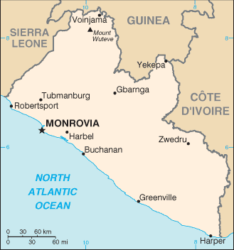 Map of Liberia
To fully understand where Liberia is today as a country and as a people, one has to understand its background and its geopolitical history. Liberia has a unique background in that it was not a European colony and was not included in the Berlin Conference of 1884 as a country up for grabs in the scramble for African territory. The conference of colonial European powers who divided up Africa did establish borders for the majority of African countries. Liberia, which means “Land of the Free,” was a destination for freed slaves from the United States.
In 1847, Liberia became an independent country patterned after the US government, even naming its capital Monrovia after President James Monroe, the fifth US president. Many of the freed slaves from the United States returned to Africa and relocated to Liberia. The slavery experience in the United States gave returning Africans a different culture and history from those indigenous to the African continent. Assimilation between the two groups was difficult. The division between the Americanized settler communities along the coast and the indigenous Africans of the interior continued to widen over the years.
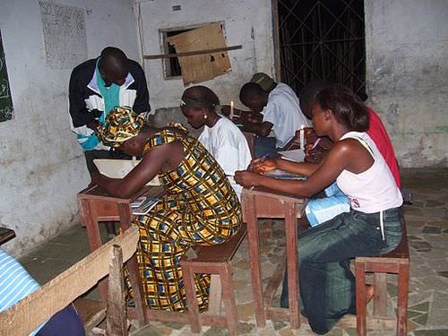 These students in Bong County, Liberia, study by candlelight. They are part of the Accelerated Learning Program in the country, an effort to compress several years of education for older students who missed school during Liberia’s civil war.
Centrifugal forces within the country surfaced in 1980 when a military-backed coup overthrew the government. This event became a turning point that escalated into social division and political unrest. Elections were held in 1985, which resulted in accusations of election fraud. Successive coups by various factions continued to plague the political arena. By 1989, civil war had commenced.
Military forces from the neighboring countries of Ghana, Guinea, Senegal, and Nigeria entered the conflict. Whoever was in charge of the government at any one time had plenty of opposition from the various factions. A warlord by the name of Charles Taylor became a major player and eventually took control of the government in 1997 following a bloody insurgency in the capital.
Marines from the United States were deployed to protect the US embassy and personnel. Nigerian military troops pushed into the conflict. By 2003, more than 15,000 peacekeeping soldiers from the United Nations (UN) were active in Liberia. The power of the government was reduced to a minimum, and the warlord president Taylor was allowed asylum in Nigeria and later brought before the UN court in The Hague for war crimes against humanity.
In the end, more than 200,000 people were killed and the country was devastated. With UN troops bringing stability, the 2005 presidential election brought Ellen Johnson-Sirleaf, an economist with a Harvard degree. She became the first elected female head of state in Africa.
Poverty and the lack of goods and services have been a persistent problem for the people of Liberia. An agrarian society, few global corporations have made investments because of the long-standing civil war. As was true for Sierra Leone and other African countries such as Angola, the diamond trade helped fund the civil war. Diamonds from Sierra Leone had an estimated export value of more than $300 million annually in 2010.
Diamonds from these countries are often called blood diamonds because of their use as currency to fund death and destruction. The concept of blood diamonds originated in the civil war in Angola years earlier. The UN banned the export of blood diamonds from Liberia during the war and finally lifted the ban in 2007. Looting and corruption by warlords and military forces pillaged the country’s other resources, leaving most of the population with few opportunities and advantages for the future.
Ivory Coast (Côte d’Ivoire)
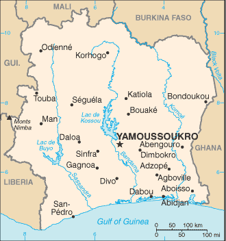 Map of the Ivory Coast
The former French colony of Ivory Coast is often referred to by its French name of Côte d’Ivoire. Before independence in 1960, Ivory Coast was one of France’s most prosperous West African colonies. During the 1960s and 1970s, the economy grew, and its production of cocoa beans became the largest in the world. Its coffee production became the third highest in the world after Brazil and Colombia. Ivory Coast is the leading exporter of palm oil and pineapples in Africa. The potential for economic prosperity remains but has been diminished over the past two decades because of the economic downturn in commodity prices and political instability that resulted in a devastating civil war.
From 1960 to 1993, the country only had one political leader. Though this brought continuity to the government and the economy grew in the early years, authoritarian rule resulted in civil unrest and dissatisfaction with the conditions in the country. Coups in 1999 and 2001 triggered the beginning of political division. Rebel leaders from the northern part of the country challenged the government’s legitimacy and pushed for land reform and a change in citizenship qualifications. Rebel groups took over the northern regions and vied for control over the prime cocoa-growing lands. Fighters under warlords and militias from Sierra Leone and Liberia encroached on the western sectors to gain a foothold.
By 2003, French troops patrolled the western border region to provide security and stability. The country experimented with a unity government, but this broke down when the rebel groups failed to disarm. By 2007 the government and rebel leaders from the north worked out an agreement to reunite the country and dismantle the dividing zone between the north and south. French and UN troops remain to help implement the peace process.
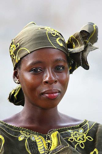 Woman in Abidjan, Ivory Coast
The people of Ivory Coast are highly diverse. Religious affiliations are evenly split between Muslim, Christian, and animist. The economic success in agricultural production and recent oil exploration have attracted people from neighboring countries seeking opportunities and advantages. After the 2007 political agreements, approximately 20 percent of the population was made up of immigrant workers from neighboring countries, which are predominantly Muslim.
The small percentage of non-Africans are from France, Lebanon, Vietnam, and Spain. There are also a high number of missionaries from North American Protestant churches. Attacks against non-native-born citizens have occurred; qualification for citizenship is a major concern, and natural-born citizens often support stronger restrictions on non-natives becoming citizens or holding political offices.
Ghana
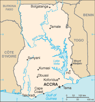 Map of Ghana
Named after the former Ghana Empire, the region of the Gold Coast was home to the Ashanti kingdom, which thrived in the slave trade. Many of the European colonial powers had sought to build fortified beachheads on the coast and profit from the lucrative trade in slaves, gold, and ivory. In the end, it was the British that dominated the region and established the Gold Coast colony. The push for independence came in 1957. Ghana was the first European colony to gain independence in Sub-Saharan Africa.
Ghana remains a poor country, but it is endowed with natural resources. Even with half the population employed in agriculture, the country is experiencing positive economic growth. Gold and other mining operations contribute to the economy. Individual remittances and foreign aid remain a necessary component of the country’s economic well being.
Kwame Nkrumah was the first prime minister and the first president. He advocated for a Pan-African concept that would pull the African countries together, opposed neocolonial activity, and increased trade and interaction within the African community. His ideas were welcome and are still celebrated, but his authoritarian rule brought about his downfall. In 1966, he was ousted in a military coup and exiled to Guinea.
The political dynamics that followed were typical of the region with a pattern of corruption, coups, and authoritarian rule. It was not until 1981, when Jerry Rawlings came to power, that all political parties were banned and a new constitution was introduced. By 1992, the political parties were reinstated and the country began to experience political stability and democratic rule, which has endured to the present, making Ghana one of the most stable democracies in Sub-Saharan Africa.
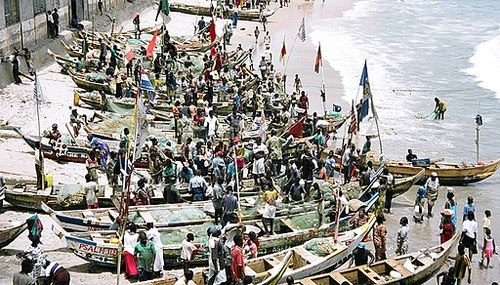 Ghana is a former British colony and was one of the first African colonies to gain independence (1957). Fishing is still a major economic activity along the coast.
Ghana is diverse in its people and in its physical geography. The physical terrain ranges from coastal plains and interior hills to the large Volta basin in the center. The Volta River was dammed up to produce hydroelectric power, resulting in the world’s largest artificial lake, Lake Volta, which covers a large portion of eastern Ghana.
The cultural diversity is exemplified by many ethnic groups, more than 80 languages, and at least double that in the number of dialects spoken within the country. English is the official language and is used in all public education. Funding for education has been available, and the people have access to quality educational services and an increasing agenda of social services. Ghana is showing promise in providing its people with a stable and thriving prospect for growth and opportunities.
Burkina Faso
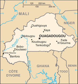 Map of Burkina Faso
Upstream on the Volta River is the former French colony of Upper Volta. In 1960, the former French colony attained full independence, and its name was changed in 1984 to Burkina Faso, meaning “the country of honorable people.” Burkina Faso is a landlocked nation without a port city. The country lacks natural resources and has few industries. Subsistence agriculture is the main economic activity for about 90 percent of the population. Droughts and desertification continue because of overgrazing of the land and the natural southward shift of the Sahara Desert. Rainfall varies from forty inches in the south to only ten inches in the north. This is one of the poorest nations on Earth.
Political unrest and a series of military coups after independence have not provided stability. The current president has been in power since 1987 and continues to win in presidential elections. New limits may restrict his term in office past 2015. Many people seek employment in the neighboring countries of Ivory Coast and Ghana. This extremely poor nation occupies the second-to-last place on the UN’s human development index. At less than 25 percent, Burkina Faso has the lowest literacy rate in the world. The poor economy offers few resources to increase educational services.
Togo and Benin
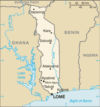 Map of Togo
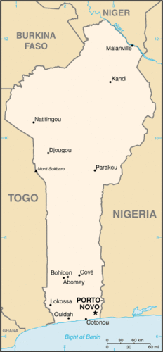 Map of Benin
Both Togo and Benin were French colonies at the time of independence. The Berlin Conference in 1884 accepted Germany’s control over the coastal region that became Togoland in 1905. After World War I, Germany lost this colony and the territory was administered between the British and the French. The French colony of Dahomey eventually became independent in 1960 and changed its name to the People’s Republic of Benin in 1975.
Togo and Benin are both elongated countries with major port cities on the Gulf of Guinea along the Atlantic coast. Benin is about the same size in area as Liberia or the US state of Kentucky. Benin is twice the size in physical area as Togo. The south is a few degrees cooler than the north, where the scrub forests and grasslands of the savanna-type landscape can be more arid, as it is closer to the African Transition Zone. A nature reserve and a national park in Benin’s northern portion attract tourists to see big game animals such as elephants, lions, and hippos in their natural environment. Both countries have a poor economy with most of the people working in agriculture. The political dynamics are similar to other West African states.
Nigeria
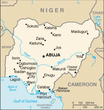 Map of Nigeria
Africa’s most populous country is Nigeria. The exact population has been difficult to determine, but 2017 estimates report the population to be more than 190 million. This is a country of more than 250 different ethnic groups with twice that many separate languages or dialects. English is the official language, along with Hausa, Yoruba, and Igbo (Ibo), all of which are spoken by 10 million people or more. The distribution of the major ethnic groups is illustrated by the different regions of the country.
Hausa groups are found mainly in the northern region, Kanuri groups in the northeast, Yoruba in the southwest, and Igbo (Ibo) in the southeast. Ethnic division has also caused serious confrontations and violence. In 1967, a separatist movement in the eastern Igbo region created the independent nation of Biafra. This sparked an all-out civil war that lasted more than two years and resulted in more than one million deaths. Political divisions did not end even after the two sides reconciled and the country was united under the same government in 1970. Political instability in Nigeria has resulted in an almost endless number of military coups and government leaders being removed from office.
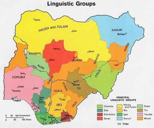 There are many linguistic groups in Nigeria but only four main ethnic groups: Yoruba, Hausa, Kanuri, and Igbo (Ibo), each in the four corners of the country.
The size and diversity of this country create a host of centrifugal forces that can bring about divisions along any number of cultural lines. Religious issues add to political instability. The north is mainly Muslim, as it is located in the African Transition Zone. The south is mainly Christian. A large percentage of the population follows animist religions with many different traditional beliefs. Clashes have erupted in the streets that pit Muslims and Christians against each other. Several northern provinces have pushed to have the Sharia criminal code made into the area’s civil law. There are regions where it is not uncommon for people to have a mix of Christian and animist beliefs.
Family size has been large in Nigeria, which has caused an exploding population. Statistically, Nigeria has more people of African heritage than any other country in the world. The population density is equivalent to having half the population of the United States pushed into an area the size of Texas and Oklahoma. Most of the population makes their living on subsistence agriculture, but millions are employed in the growing urban service sector.
Nigeria’s main economic engine is the oil industry, which accounts for up to 80 percent of government revenues and is the number one export product. Nigeria is a member of the Organization of Petroleum Exporting Countries (OPEC) and is one of the world’s top ten oil-exporting countries. The lucrative oil business has attracted many seeking to share in the profits.
The government’s distribution of oil revenues has brought about even more infighting, corruption, and mismanagement within the political leadership. Rebels and militant groups along the Niger Delta, where most of the oil activity is located, have attacked the oil industry’s infrastructure and taken workers hostage. They want a larger share of the revenues to remain in Nigeria and to go to their people rather than the government or CEOs of international corporations.
Poverty, a low standard of living, the lack of opportunities and advantages, a poor educational system, or the lack of social services does not diminish the human spirit. Confronting all these issues and more, the people of West Africa and Nigeria are vibrant, energetic, and hard working and value the institutions of family and religion. Just because they have not transitioned to a consumer society does not mean they cannot find fulfillment and happiness in their lives.
A survey conducted by social scientists in 2001 and reported by BBC News in 2003, indicated that Nigeria had the highest percentage of happy people of any country in the world at that time. The status of each country may change from year to year, but the interesting part is that the survey confirmed that money or income level does not always equate to happiness.
Countries such as Nigeria, with a low level of per-capita income, can still highly value their heritage and the traditions that revolve around their family and community and transcend the global push for economic gain and the possession of consumer items. Much can be said for the vibrant cultural attributes of the people of West Africa and its developing countries.
- Most of West Africa lies in the African Transition Zone, with portions north and south of the transitional region. Dry, desert conditions exist to the north and tropical conditions exist to the south.
- The main economic activity in the region is subsistence agriculture. Minerals, diamonds, or oil are also extracted in varying amounts in West Africa.
- West Africa has a large number of independent states that share similar economic qualities of poverty with rapidly expanding populations. Foreign aid and international assistance have been extensive.
- The transition from a colony to an independent nation has not been without serious political conflicts. Bloody civil wars, military coups, and political unrest have plagued the region.
- In spite of the political difficulties, poverty and the lack of resources, the people of West Africa hold vibrant cultural values that revolve around family and religion. The diversity of languages, religious beliefs, and rich cultural traditions provide an African heritage that is celebrated and valued by its people.
Vocabulary Terms
|
People who live in what is now called Ghana, in west Africa, and who are known for their artful weaving and colorful asasia, or kente cloth |
|
|
an island off the coast of Senegal that served as a major departure point for slaves during the slave trade |
|
|
an impressive city that is completely safe. The city has many beautiful mosques |
|
|
first used by Berber nomads, could travel 60 miles a day and go longer than other animals without water |
Applying Knowledge
Discussion and Study Questions
- What has been the general political pattern after independence in West Africa?
- Which country has the highest number of ethnic groups? What are the four main ethnic groups there?
- Why are Senegal and the Gambia two separate countries? What river flows through this area?
- How do most of the people in West Africa make a living?
- What are blood diamonds? What two countries in West Africa have had civil wars based on them?
- How did Liberia become a country? Why was Liberia never colonized by Europeans?
- With more than eighty indigenous languages, why is English the official language of Ghana?
- What was the Pan-African concept, and how did it affect West Africa?
- How have natural resources contributed to the wealth of the region?
- How will these countries address their high population growth in the future?
Real-World Geography Exercise
- Using Google Maps, complete the following activities:
- Locate each place on the bulleted list below.
- Find the nearest city with an international airport in proximity to each location on the bulleted list below.
- Calculate the distance and travel time by plane to each city from the San Francisco International Airport.
- Using NASA Latitude and Longitude Finder, determine the latitude and longitude for each location on the bulleted list below.
- Be prepared to share and discuss your answers.
- Cameroon Highlands
- Gambia River
- Lake Volta
- Niger Delta
- Timbuktu
- Volta River
Mapping Exercise
Malaria: Students will investigate the spatial patterns of malaria risks. Students will analyze environmental factors related to malaria control in Africa.
Helpful Websites for the Study of Geography
Canadian Encyclopedia is an encyclopedia funded by the Canadian government covering all branches of knowledge. Their scholarly collection includes interactive materials.
CIA World Factbook provides information on the people, history, government, economy, energy, geography, communications, transportation, military, and transnational issues for the world's entities.
Congress.gov is a US government website where you can find federal legislation, past and present, as well as information about the US legal system.
Drug Enforcement Administration (DEA) is a government agency website that provides current news, resources, topics of interest, information about drugs, careers in the DEA, and a tip hotline.
Library of Congress is the largest library in the world and provides manuscripts, files, information, pictures, and videos.
NASA Earth Observatory (NEO) is a US government agency website that allows users to search for and retrieve satellite images of Earth.
National Archives is a US government website that provides historical documents, photos, records, publications, and educator resources.
National Oceanic and Atmospheric Association (NOAA) is a US government agency website that provides weather-related information and ocean research.
National Map is a website by the United States Geological Survey and other federal, state, and local agencies that delivers topographic information for the United States.
NationMaster is a massive central data source and a handy way to graphically compare nations.
Real-Time World Air Quality Index is a website that measures most locations in the world for air pollution in real time.
StateMaster is a unique statistical database, which allows you to research and compare a multitude of different data on US states.
United Nations (UN) is an international organization founded in 1945 and made up of 193 member states. The UN maintains international peace and security, protects human rights, delivers humanitarian aid, promotes sustainable development, and upholds international law.
United States Census Bureau is a US government agency that provides a population clock, data, surveys, statistics, a library with information and infographics, news about the economy, and much more.
United States Geological Survey (USGS) is a US government agency website that provides scientific information about the natural hazards that threaten lives, the natural resources we rely on, the health of our ecosystems and environment, and the impacts of climate and land-use change.
Whitehouse.gov is a US government website that provides the latest presidential news, information about the budget, policy, defense, and many more topics.
World Health Organization (WHO) is under the United Nations and provides leadership on matters critical to health, shapes the research agenda on health, and monitors the health situation and assessing health trends around the world. Their website provides information on the state of health around the world, outbreaks, current health news, and more.
World Trade Organization (WTO) is an intergovernmental organization that regulates international trade. The website provides information on the history of the multilateral trading system, featured videos, news and events, trade topics, and more.