
11.4: The Pacific Islands (2 Days)
- Page ID
- 1986
\( \newcommand{\vecs}[1]{\overset { \scriptstyle \rightharpoonup} {\mathbf{#1}} } \)
\( \newcommand{\vecd}[1]{\overset{-\!-\!\rightharpoonup}{\vphantom{a}\smash {#1}}} \)
\( \newcommand{\dsum}{\displaystyle\sum\limits} \)
\( \newcommand{\dint}{\displaystyle\int\limits} \)
\( \newcommand{\dlim}{\displaystyle\lim\limits} \)
\( \newcommand{\id}{\mathrm{id}}\) \( \newcommand{\Span}{\mathrm{span}}\)
( \newcommand{\kernel}{\mathrm{null}\,}\) \( \newcommand{\range}{\mathrm{range}\,}\)
\( \newcommand{\RealPart}{\mathrm{Re}}\) \( \newcommand{\ImaginaryPart}{\mathrm{Im}}\)
\( \newcommand{\Argument}{\mathrm{Arg}}\) \( \newcommand{\norm}[1]{\| #1 \|}\)
\( \newcommand{\inner}[2]{\langle #1, #2 \rangle}\)
\( \newcommand{\Span}{\mathrm{span}}\)
\( \newcommand{\id}{\mathrm{id}}\)
\( \newcommand{\Span}{\mathrm{span}}\)
\( \newcommand{\kernel}{\mathrm{null}\,}\)
\( \newcommand{\range}{\mathrm{range}\,}\)
\( \newcommand{\RealPart}{\mathrm{Re}}\)
\( \newcommand{\ImaginaryPart}{\mathrm{Im}}\)
\( \newcommand{\Argument}{\mathrm{Arg}}\)
\( \newcommand{\norm}[1]{\| #1 \|}\)
\( \newcommand{\inner}[2]{\langle #1, #2 \rangle}\)
\( \newcommand{\Span}{\mathrm{span}}\) \( \newcommand{\AA}{\unicode[.8,0]{x212B}}\)
\( \newcommand{\vectorA}[1]{\vec{#1}} % arrow\)
\( \newcommand{\vectorAt}[1]{\vec{\text{#1}}} % arrow\)
\( \newcommand{\vectorB}[1]{\overset { \scriptstyle \rightharpoonup} {\mathbf{#1}} } \)
\( \newcommand{\vectorC}[1]{\textbf{#1}} \)
\( \newcommand{\vectorD}[1]{\overrightarrow{#1}} \)
\( \newcommand{\vectorDt}[1]{\overrightarrow{\text{#1}}} \)
\( \newcommand{\vectE}[1]{\overset{-\!-\!\rightharpoonup}{\vphantom{a}\smash{\mathbf {#1}}}} \)
\( \newcommand{\vecs}[1]{\overset { \scriptstyle \rightharpoonup} {\mathbf{#1}} } \)
\(\newcommand{\longvect}{\overrightarrow}\)
\( \newcommand{\vecd}[1]{\overset{-\!-\!\rightharpoonup}{\vphantom{a}\smash {#1}}} \)
\(\newcommand{\avec}{\mathbf a}\) \(\newcommand{\bvec}{\mathbf b}\) \(\newcommand{\cvec}{\mathbf c}\) \(\newcommand{\dvec}{\mathbf d}\) \(\newcommand{\dtil}{\widetilde{\mathbf d}}\) \(\newcommand{\evec}{\mathbf e}\) \(\newcommand{\fvec}{\mathbf f}\) \(\newcommand{\nvec}{\mathbf n}\) \(\newcommand{\pvec}{\mathbf p}\) \(\newcommand{\qvec}{\mathbf q}\) \(\newcommand{\svec}{\mathbf s}\) \(\newcommand{\tvec}{\mathbf t}\) \(\newcommand{\uvec}{\mathbf u}\) \(\newcommand{\vvec}{\mathbf v}\) \(\newcommand{\wvec}{\mathbf w}\) \(\newcommand{\xvec}{\mathbf x}\) \(\newcommand{\yvec}{\mathbf y}\) \(\newcommand{\zvec}{\mathbf z}\) \(\newcommand{\rvec}{\mathbf r}\) \(\newcommand{\mvec}{\mathbf m}\) \(\newcommand{\zerovec}{\mathbf 0}\) \(\newcommand{\onevec}{\mathbf 1}\) \(\newcommand{\real}{\mathbb R}\) \(\newcommand{\twovec}[2]{\left[\begin{array}{r}#1 \\ #2 \end{array}\right]}\) \(\newcommand{\ctwovec}[2]{\left[\begin{array}{c}#1 \\ #2 \end{array}\right]}\) \(\newcommand{\threevec}[3]{\left[\begin{array}{r}#1 \\ #2 \\ #3 \end{array}\right]}\) \(\newcommand{\cthreevec}[3]{\left[\begin{array}{c}#1 \\ #2 \\ #3 \end{array}\right]}\) \(\newcommand{\fourvec}[4]{\left[\begin{array}{r}#1 \\ #2 \\ #3 \\ #4 \end{array}\right]}\) \(\newcommand{\cfourvec}[4]{\left[\begin{array}{c}#1 \\ #2 \\ #3 \\ #4 \end{array}\right]}\) \(\newcommand{\fivevec}[5]{\left[\begin{array}{r}#1 \\ #2 \\ #3 \\ #4 \\ #5 \\ \end{array}\right]}\) \(\newcommand{\cfivevec}[5]{\left[\begin{array}{c}#1 \\ #2 \\ #3 \\ #4 \\ #5 \\ \end{array}\right]}\) \(\newcommand{\mattwo}[4]{\left[\begin{array}{rr}#1 \amp #2 \\ #3 \amp #4 \\ \end{array}\right]}\) \(\newcommand{\laspan}[1]{\text{Span}\{#1\}}\) \(\newcommand{\bcal}{\cal B}\) \(\newcommand{\ccal}{\cal C}\) \(\newcommand{\scal}{\cal S}\) \(\newcommand{\wcal}{\cal W}\) \(\newcommand{\ecal}{\cal E}\) \(\newcommand{\coords}[2]{\left\{#1\right\}_{#2}}\) \(\newcommand{\gray}[1]{\color{gray}{#1}}\) \(\newcommand{\lgray}[1]{\color{lightgray}{#1}}\) \(\newcommand{\rank}{\operatorname{rank}}\) \(\newcommand{\row}{\text{Row}}\) \(\newcommand{\col}{\text{Col}}\) \(\renewcommand{\row}{\text{Row}}\) \(\newcommand{\nul}{\text{Nul}}\) \(\newcommand{\var}{\text{Var}}\) \(\newcommand{\corr}{\text{corr}}\) \(\newcommand{\len}[1]{\left|#1\right|}\) \(\newcommand{\bbar}{\overline{\bvec}}\) \(\newcommand{\bhat}{\widehat{\bvec}}\) \(\newcommand{\bperp}{\bvec^\perp}\) \(\newcommand{\xhat}{\widehat{\xvec}}\) \(\newcommand{\vhat}{\widehat{\vvec}}\) \(\newcommand{\uhat}{\widehat{\uvec}}\) \(\newcommand{\what}{\widehat{\wvec}}\) \(\newcommand{\Sighat}{\widehat{\Sigma}}\) \(\newcommand{\lt}{<}\) \(\newcommand{\gt}{>}\) \(\newcommand{\amp}{&}\) \(\definecolor{fillinmathshade}{gray}{0.9}\)- List the three main areas of the South Pacific.
- Explain the difference between low islands and high islands.
- List which islands remain under the control of France, the United Kingdom, New Zealand, or the United States.
- Describe the primary economic activities of the islands in the realm.
- Summarize the main environmental concerns of the islands in each region.
TEKS Regional Unit 11 Oceania: Chapter 11.4 The Pacific Islands
WG.1A Analyze the effects of physical and human geographic patterns and processes on the past and describe their impact on the present, including significant physical features and environmental conditions that influenced migration patterns and shaped the distribution of culture groups today.
WG.2A Describe the human and physical characteristics of the same regions at different periods of time to evaluate relationships between past events and current conditions.
WG.3A Explain weather conditions and climate in relation to annual changes in Earth-Sun relationships.
WG.3B Describe the physical processes that affect the environments of regions, including weather, tectonic forces.
WG.4A Explain how elevation, latitude, wind systems, ocean currents, position on a continent, and mountain barriers influence temperature, precipitation, and distribution of climate regions.
WG.4B Describe different landforms and the physical processes that cause their development.
WG.4C Explain the influence of climate on the distribution of biomes in different regions.
WG.5A Analyze how the character of a place is related to its political, economic, social, and cultural elements.
WG.6A Locate and describe human and physical features that influence the size and distribution of settlements.
WG.6B Explain the processes that have caused changes in settlement patterns, including urbanization, transportation, access to and availability of resources, and economic activities.
WG.8A Compare ways that humans depend on, adapt to, and modify the physical environment, including the influences of culture and technology.
WG.8B Describe the interaction between humans and the physical environment and analyze the consequences of extreme weather and other natural disasters such as El Nino, floods. tsunamis, and volcanoes.
WG.8C Evaluate the economic and political relationships between settlements and the environments, including sustainable development and renewable/non-renewable resources.
WG.9A Identify physical and/or human factors such as climate, vegetation, language, trade networks, political units, river systems, and religion that constitute a region.
WG.10C Compare the ways people satisfy their basic needs through the production of goods and services such as subsistence agriculture versus commercial agriculture or cottage industries versus commercial industries.
WG.10D Compare global trade patterns over time and examine the implications of globalization, including outsourcing and free trade zones.
WG.11B Identify factors affecting the location of different types of economic activities, including subsistence and commercial agriculture manufacturing, and service industries.
WG.11C Assess how changes in climate, resources, and infrastructure (technology, transportation, and communication) affect the location and patterns of economic activities.
WG.18A Analyze cultural changes in specific regions caused by migration, war, trade, innovations, and diffusion.
WG.18C Identify examples of cultures that maintain traditional ways, including traditional economies.
WG.18D Evaluate the spread of cultural traits to find examples of cultural convergence and divergence such as the spread of democratic ideas, US-based fast-food franchises, the English langue, technology, or global sports.
WG.21A Analyze and evaluate the validity and utility of multiple sources of geographic information such as primary and secondary sources, aerial photographs, and maps.
WG.21C Create and interpret different types of maps to answer geographic questions, infer relationships, and analyze change.
WG.22A Design and draw appropriate graphics such as maps, diagrams tables, and graphs to communicate geographic features, distributions, and relationships.
WG.22B Generate summaries, generalizations, and thesis statements supported by evidence.
WG.22E Create original work using proper citations and understanding and avoiding plagiarism.
TEKS and ELPS for Regional World Geography Unit 11--Oceania from TEKS Resource System.
The Pacific Islands
Introducing the Realm
The Pacific realm is home to many islands and island groups. The largest island is New Guinea, which is home to most of the realm’s population. Many of the Pacific islands have become independent countries, while others remain under the authority of other countries. The Pacific Theater of World War II was a battleground between the Japanese and American forces and had an impact on many of the islands. The Hawaiian Islands became the 50th US state in 1959.
The many islands can be divided into three main groups based on physical geography, local inhabitants, and location: Melanesia, Micronesia, and Polynesia. Indigenous cultural heritage remains strong in the South Pacific, but Western culture has made deep inroads into people’s lives. The globalization process bears heavily on the economic conditions that influence the cultural dynamics of the Pacific.
Islands or island groups that remain under outside political jurisdiction are the most influenced by European or American cultural forces. Western trends in fast food, pop music, clothing styles, and social customs often dominate television, radio, and the cinema. Western culture takes the focus away from the traditional indigenous culture and heritage of the people who inhabited these isolated islands for centuries.
Traditionally, the islands were economically self-sufficient. Fishing and growing crops were the main economic activities, and nearby islands often established trade and exchanged natural resources. Fishing has been one of the most common ways of supporting the economy. There have been changes in the national boundaries to protect offshore fishing rights around each sovereign entity. Many waters have been overfished, consequently reducing the islands’ ability to provide food for their people or to gain national wealth. An increase in population and the introduction of modern technologies has brought about a dependency on the world’s core areas for economic support.
The Pacific is a peripheral realm with little to offer to the core areas economically. In recent decades, some national wealth has been gained from the mining of substances as phosphates on a few of the islands. The main resources available are a pleasant climate, beautiful beaches, and tropical island terrain, all of which can be attractive to tourists and people from other places.
Tourism is a growing sector of the service industry and a major means of gaining wealth for various island groups. To attract tourism, the islands must invest in the necessary infrastructure, such as airports, hotels, and supporting services. Long distances between islands and remote locations make tourism transportation expensive. Not every island has the funding to support these expenditures to draw tourists to their location.
Melanesia
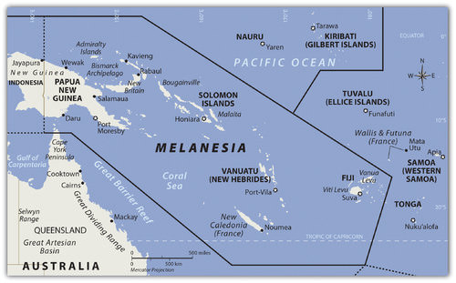 Map of Melanesia
 The region of the Pacific north of Australia that borders Indonesia to the east is called Melanesia. The name originally referred to people with darker skin but does not adequately describe the region’s current ethnic diversity. The main island groups include Fiji, New Caledonia, Vanuatu, the Solomon Islands, and Papua New Guinea. All are independent countries except New Caledonia, which is under the French government. The island of New Guinea is shared between Papua New Guinea and Indonesia. Many islands on the eastern side of Indonesia share similar characteristics but are not generally included in the region of Melanesia.
Independent Countries of Melanesia
- Fiji
- Papua New Guinea
- Solomon Islands
- vanuatu
Other Island Groups
- New Caledonia (France)
Papua New Guinea
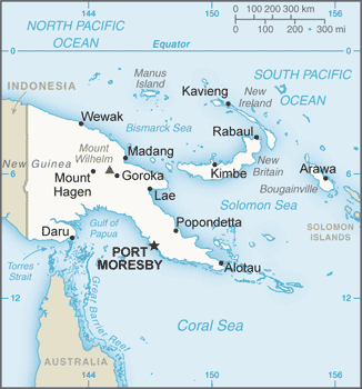 Map of Papua New Guinea
Papua New Guinea is the largest country in the Pacific realm and therefore the largest in Melanesia. It is diverse in both physical terrain and human geography. The high mountains of the interior reach 14,793 feet. Snow has been known to fall in the higher elevations even though they are located near the equator. Many local groups inhabit the island, and more than 700 separate languages are spoken, more than in any other country in the world. Indigenous traditions create strong centripetal forces. Papua New Guinea received independence in 1975 and is working toward fitting into the global community.
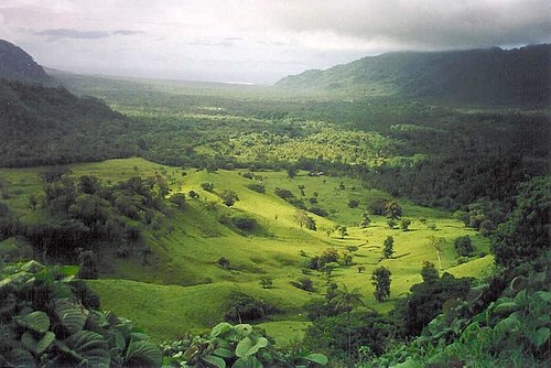
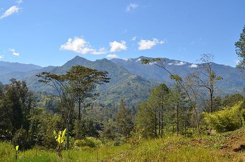.jpg?revision=1) The New Guinea Highlands, also known as the Central Range or Central Cordillera, is a chain of mountain ranges and intermountain river valleys on Papua New Guinea.
The New Guinea Highlands, also known as the Central Range or Central Cordillera, is a chain of mountain ranges and intermountain river valleys on Papua New Guinea. Papua New Guinea is a diverse country that still has many mysteries to be revealed in its little-explored interior. The country’s large physical area provides greater opportunities for the exploitation of natural resources for economic gain. The interior of the island has large areas that have not been exploited by large-scale development projects. In the past few decades, oil was discovered and makes up its largest export item. Gold, copper, silver, and other minerals are being extracted in extensive mining operations, often by outside multinational corporations. Subsistence agriculture is the main economic activity of most of the people. Coffee and cocoa are examples of agricultural exports.
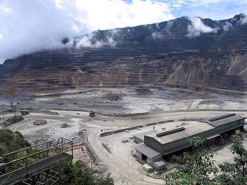 The Ok Tedi Mine is an open-pit copper and gold mine in Papua New Guinea.
 A number of islands off Papua New Guinea’s eastern coast—including Bougainville—have valuable mineral deposits. Bougainville and the islands under its jurisdiction are physically a part of the Solomon Island archipelago but are politically an autonomous region of Papua New Guinea. Volcanic vents deep under the sea continue to bring hot magma and minerals to the surface of the ocean floor, creating valuable resources. Papua New Guinea has laid claim to these islands and the underwater resources within their maritime boundaries. Rebel movements have pushed for the independence of the Autonomous Region of Bougainville but have been unsuccessful. The islands remain under the government of Papua New Guinea.
Solomon Islands
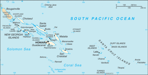 Map of the Solomon Islands
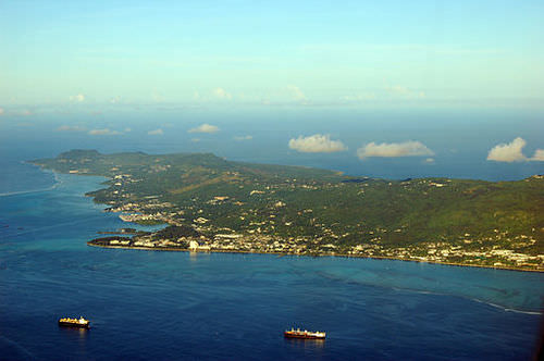
 To the east of the island of Guinea are the Solomon Islands, a group of more than 1,000 islands. About 80 of them hold most of the population of more than one-half of a million people. The island of Guadalcanal was the site of some of the fiercest fighting in World War II between Japan and the United States. Honiara, the capital city, is on Guadalcanal.
The Solomon Islands were a colony of Great Britain but gained independence in 1978. Colonialism, World War II, and ethnic conflict on the islands created serious centrifugal cultural forces, divisions, and political tensions over the past few decades. In 2003, military and police troops from other islands and Australia intervened to restore order after ethnic tension erupted into civil unrest.
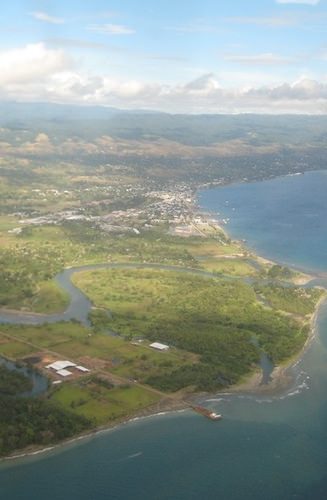 Honiara is the capital city of the Solomon Islands on the northwestern coast of Guadalcanal.
 Shifting tectonic plates are the source of environmental problems. Active seismic activity has created earthquakes and tsunami conditions that have brought devastation to the region. An earthquake of 8.1 magnitude hit the Solomon Islands in 2007, bringing high waves and many aftershocks. The tsunami killed at least 52 people, and as many as 1,000 homes were destroyed. The islands contain several active and dormant volcanoes. Tropical rain forests cover a number of the islands and are home to rare orchids and other organisms. There is a concern that these resources might be harmed by deforestation and the exploitation of resources for economic gain.
vanuatu
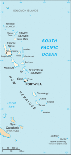 Map of Vanuatu
 The country of Vanuatu was inhabited by a large number of South Pacific groups. As a result, many languages are spoken within a relatively small population. The French and the British both colonized the island archipelago. It was called the New Hebrides before independence in 1980 when the name was changed to Vanuatu. These small volcanic islands have an active volcano and have experienced earthquakes in recent years. One of Vanuatu’s means of bringing in business has been to establish offshore banking and financial services, similar to what is found in the Caribbean. Many shipping firms register their ships there because of the advantages of lower taxes and flexible labor laws.
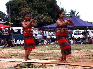
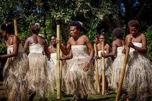 A women's dance from Vanuatu, using bamboo stamping tubes.
New Caledonia
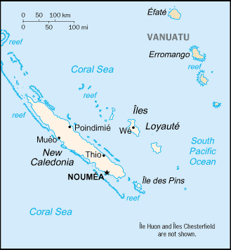 Map of New Caledonia
 New Caledonia is still a colony of France and was once a French prison colony. Under a current agreement, sovereignty is slowly being turned over to the local island government. Periodic reevaluations of the local government will be conducted to see if independence can be granted.
New Caledonia has historically relied on subsistence agriculture and fishing for its livelihood. About 25 percent of the world’s known nickel resources are located here. Nickel resources will substantially affect the economy, bring in foreign investments, and raise the standard of living.
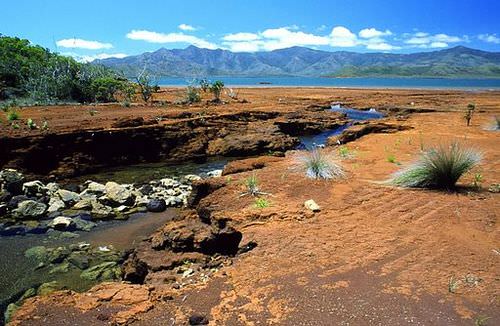 A creek in southern New Caledonia. Red colors reveal the richness of the ground in iron oxides and nickel.
Fiji
 Map of Fiji
Fiji is located in the eastern sector of Melanesia and has almost one million people. The country includes more than 100 inhabitable islands, but two are home to most of the population. Colonialism heavily impacted the population’s ethnic makeup. During British colonial rule, thousands of workers from South Asia were brought in by the British to work on the sugar plantations. After a century of British rule, Fiji became independent in 1970.
The people of South Asian descent remained in Fiji and now make up more than one-third of the population. Ethnic conflicts erupted on the political scene between the Melanesian majority and the South Asian minority. Political coups and coalition governments have attempted to work out political solutions with limited success. Fiji is well developed and has a substantial tourism industry that increases the income of the island.
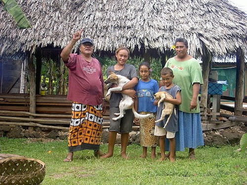
 Several bures (one-room Fijian houses) in the village of Navala in the Nausori Highlands.
Micronesia
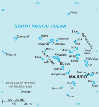
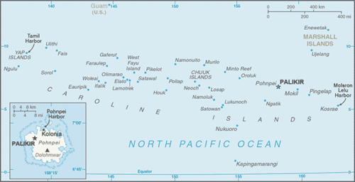 Map of Micronesia
North of the Solomon Islands and Papua New Guinea is the large region of Micronesia. The “micro” portion of the name refers to the fact that the islands are small in size—often only one square mile or so in physical area. The region has more than 2,000 islands. Most of the islands are composed of coral and do not extend above sea level to any large extent. These low islands dominate the high islands. The high islands are usually of volcanic origin and reach elevations in the thousands of feet.
Guam
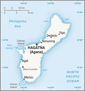 Map of Guam
 The largest island in Micronesia is Guam. It is only 210 square miles in area and reaches an elevation of 1,335 feet at its highest point. Coral reefs surround Guam’s volcanic center. Guam is not an independent country but a US possession. The island was a strategic location during World War II, and the United States has major military installations located on the island.
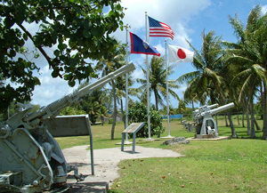 The War in the Pacific National Historical Park is a protected area in the United States territory of Guam.
Northern Mariana Islands
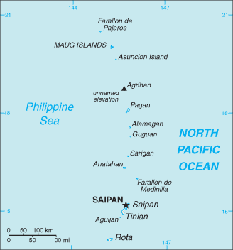 Map of Northern Mariana Islands
The Northern Mariana Islands are next to Guam and are current US possessions, along with Wake Island in the northeast. The US administers the United Nations Trust Territory of the Federated States of Micronesia. Implemented in 1986 and renewed again in 2004, the islands entered into the Compact of Free Association with the United States and established an independent status.
 The Northern Mariana Islands, officially the Commonwealth of the Northern Mariana Islands is an insular area and commonwealth of the United States.
Nauru
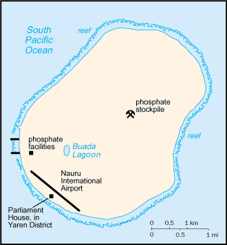 Map of Nauru
 The independent island country of Nauru is only about eight square miles in physical area, but its large phosphate deposits created enormous wealth for its small population. Once the phosphates had been mined, however, there were little means to gain wealth on such a small island with a devastated landscape. Many on Nauru are trying to live off the investments from their mining wealth or have moved to find a livelihood elsewhere.
.jpg?revision=1) Nauru has no armed forces, though there is a small police force under civilian control.
Nauru has no armed forces, though there is a small police force under civilian control. Independent Countries of Micronesia
- Federated States of Micronesia
- Kiribati (Western)
- Marshall Islands
- Nauru
- Palau
Other Island Groups
- Guam (US)
- Gilbert Islands (Kiribati)
- Northern Mariana Islands (US)
- Wake Island (US)
Palau
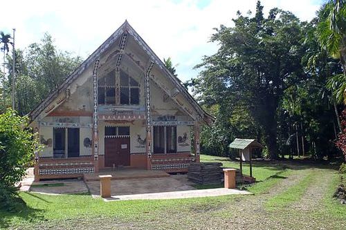
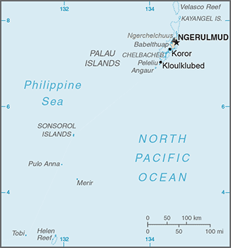 Map of Palau
 Palau, located in western Micronesia, has a population of about 21,000 people and an area of about 177 square miles. Its early inhabitants included people from Asia and from the Pacific realm. British explorers arrived early on the island, but Spain dominated it during the colonial era. After losing the Spanish-American War, Spain sold the island to Germany, which implemented mining operations on the island.
 Palauan society follows a very strict matrilineal system.
 After its defeat in World War I, Germany lost the island to Japan. Japan used it as a strategic outpost but was defeated in World War II and had to give up all its external possessions. After 1945, Palau was held by the United States and the United Nations. In 1994, the island opted for independence and retained an agreement of free association with the United States. The United States has held strategic military installations on Palau and other islands in Micronesia. Palau’s economic and geopolitical dynamics are highly reflective of US activities in the region.
.jpg?revision=1) Palau's territory consists of an archipelago located in the Pacific Ocean. Its most populous islands are Angaur, Babeldaob, Koror, and Peleliu.
Palau's territory consists of an archipelago located in the Pacific Ocean. Its most populous islands are Angaur, Babeldaob, Koror, and Peleliu.Marshall Islands
 Map of Marshall Islands
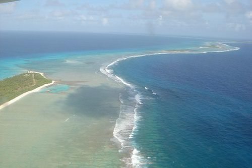
Marshall Islands, on the eastern side of Micronesia, experienced serious devastation from the conflict between Japan and the United States during World War II. The Marshall Islands became a testing ground for US nuclear weapons. Atomic bombs were tested on various atolls, rendering them uninhabitable. An atoll is a coral island that surrounds a lagoon.
 The nuclear testing at Bikini Atoll program was a series of 23 nuclear devices detonated by the United States between 1946 and 1958.
 From 1946 to 1958, the United States conducted 67 atmospheric nuclear tests in the Marshall Islands. The largest was known as the Bravo test, which included the detonation of a nuclear device over Bikini Atoll that was 1,000 times more powerful than the atomic bomb dropped on Hiroshima during World War II. There are concerns about radioactive fallout that may still affect the people who inhabit nearby atolls. The Marshall Islands were granted independence in 1986 with an agreement with the United States to provide aid and protection in exchange for the use of US military bases on the islands.
Polynesia
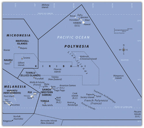 The region of Polynesia has island groups that are high islands with mountainous interiors.
 The largest region of the Pacific is Polynesia, a land of many island groups with large distances between them. The root word poly means “many.” Numerous groups of islands have come together under separate political arrangements. The region includes the Hawaiian Islands in the north and the Pitcairn Islands and Easter Island to the east. New Zealand is now studied as a part of the Austral realm, but the Maori living there are originally from Polynesia.
Polynesia has a mixture of island types ranging from the high mountains of Hawaii, which are more than 13,800 feet, to low-lying coral atolls that are only a few feet above sea level. Islands that have enough elevation to condense moisture from the clouds receive adequate precipitation, but many islands with low elevations have a shortage of fresh water, making habitation or human development difficult.
Polynesian culture stems from island resources. Fishing, farming, and an understanding of the seas created a way of life that gave Polynesia its identity. Polynesians created innovative maps that provided a means of sailing across large expanses of open seas to connect with distant islands. Their lifestyle revolved around natural resources and the creative use of natural materials. Polynesian art, music, and language reflect a diversity of cultural trends derived from a common heritage. The warm climate and beautiful islands contrast with violent destructive storms and a lack of fresh water or resources, which can make life difficult.
Independent Countries of Polynesia
- Kiribati (eastern)
- Samoa
- Tonga
- Tuvalu
Main Island Possessions
- American Samoa (US)
- Cook Islands (NZ)
- Hawaiian Islands (US)
- Pitcairn Islands (UK)
- French Polynesia (FR)
- Austral Islands
- The Marquesas
- Society Islands and Tahiti
- Tuamotu Islands
Hawaii
| Island | Nickname | Area | Population (as of 2010) |
Highest point | Elevation | Location |
|---|---|---|---|---|---|---|
| Hawaii | The Big Island | 4,028.0 sq mi (10,432.5 km2) | 185,079 | White Mountain | 13,796 ft (4,205 m) |
|
| Maui | The Valley Isle | 727.2 sq mi (1,883.4 km2) | 144,444 | House Of The Sun | 10,023 ft (3,055 m) |
|
| O'ahu | The Gathering Place | 596.7 sq mi (1,545.4 km2) | 953,207 | Mount Ka'ala | 4,003 ft (1,220 m) |
|
| Kaua'i | The Garden Isle | 552.3 sq mi (1,430.5 km2) | 66,921 | Kawaikini | 5,243 ft (1,598 m) |
|
| Moloka'i | The Friendly Isle | 260.0 sq mi (673.4 km2) | 7,345 | Kamakou | 4,961 ft (1,512 m) |
|
| Lāna'i | The Pineapple Isle | 140.5 sq mi (363.9 km2) | 3,135 | Lāna'ihale | 3,366 ft (1,026 m) |
|
| Ni'ihau | The Forbidden Isle | 69.5 sq mi (180.0 km2) | 170 | Mount Pānī'au | 1,250 ft (381 m) |
|
| Kaho'olawe | The Target Isle | 44.6 sq mi (115.5 km2) | 0 | Commonwealth | 1,483 ft (452 m) |
|

At the beginning of the 21st century, Polynesia only had four independent island groups: Kiribati, Samoa, Tonga, and Tuvalu. The rest of the many islands and island groups in Polynesia are claimed by or under the control or jurisdiction of other countries: mainly the United States, France, Great Britain, or New Zealand.
Hawaii was a sovereign and independent kingdom from 1810 to 1893, when the monarchy was overthrown and the islands became a republic that was annexed as a US territory. Hawaii became the 50th US state in 1959. Hawaii’s development pattern is modern, based on tourism from the continental United States and the US military base on Pearl Harbor.
According to the US Census, Hawaii had a population of over 1.4 million in 2017. More than one-third of the people are of Asian descent, and at least 10 percent are native Hawaiians or Pacific Islanders. The United States has a number of additional possessions in Polynesia that include various small islands, atolls, or uninhabited reefs.
The Hawaiian Islands include more islands than the few usually listed in tourist brochures. Approximately 137 islands and atolls are in the Hawaiian chain, which extends about 1,500 miles. Hawaii is one of the most remote island groups in the Pacific. The islands of the Hawaiian archipelago are a product of volcanic activity from an undersea magma source called a hotspot, which remains stationary as the tectonic plate over it continues to shift creating new volcanoes.
Mount Kilauea, an active volcano on Hawaii, the largest island in the Hawaiian chain, is considered by geologists to be one of the most active volcanoes in the world. The active volcano of Mauna Loa and two dormant volcanoes, Mauna Kea and Hualālai, are on the same island. Mauna Kea is Hawaii’s tallest mountain at 13,796 feet above sea level, which is taller than Mount Everest if measured from its base on the ocean floor.
Hawaii, like most islands of the Pacific realm, has a tropical type A climate, but snow can be found on the tops of its highest mountains during the winter months. The island of Kauai receives more than 460 inches of rain per year and is one of the wettest places on Earth. The rain shadow effect created by Mount Waialeale is the reason for the high level of precipitation. All the rain falls on the windward side of the mountain, creating a rain shadow on the leeward side of the mountain, which is a semi-desert.
Kiribati
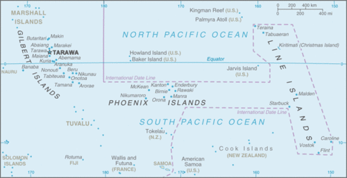 Map of Kiribati
 Kiribati includes three sets of islands located in both Micronesia and Polynesia. The main component of Kiribati is the Gilbert Island chain in Micronesia, where the capital city and most of the population are located. The other two minor island chains are the Phoenix Islands and the Line Islands in Polynesia. Both island chains were US possessions before being annexed with the Gilbert Islands to become Kiribati.
The Line Islands were used for testing of British hydrogen bombs starting in 1957. Three atmospheric nuclear tests were conducted by the British on Malden Island, and six were conducted on Christmas Island. There is concern about how radiation affected people present during the tests and thereafter. The Phoenix Islands have few inhabitants. In 2008, Kiribati declared the entire island group a protected environmental area, which made it the largest protected marine habitat in the world. Kiribati is the only country with land in all four hemispheres: north and south of the equator and on both sides of the 180° meridian.
Samoa
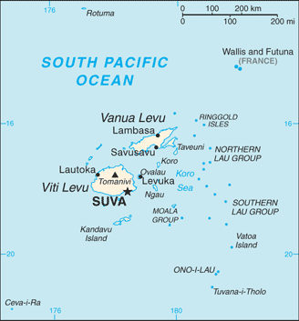
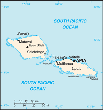 Map of Samoa
 After the colonial era, Samoa was divided into Western Samoa and Eastern Samoa. The United States controlled the eastern islands, which are referred to as American Samoa. Before World War I, Germany gained control of the larger, more extensive western islands only to lose them to New Zealand after the war. Western Samoa was under the New Zealand government until 1962, when it gained independence. The name was officially changed from Western Samoa to Samoa in 1997.
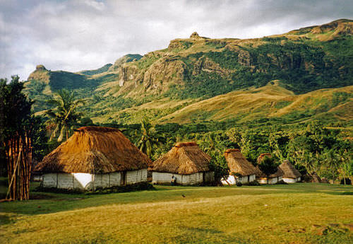
The Samoan Islands are volcanic, and the most active volcano last erupted in 1906. In Samoa, three-quarters of more than 200,000 people live on the larger of the two main islands. Colonialism has had a major impact on the culture, especially in the case of religion. Christianity became widespread once it was introduced and is now the religion of about 99 percent of the population.
 Samoa lies south of the equator, about halfway between Hawaii and New Zealand.
 American music and societal trends are also a major influence on the islands because of migration between Hawaii and the US mainland. Many Samoans have moved to the United States and established communities. Cultural traditions have been preserved and are often integrated into modern society. Samoa has some of the oldest history and traditions of Polynesia.
For many years, the United States has held an extensive naval station in the bay of Pago Pago on American Samoa. During World War II, there were more US military personnel on the islands than Samoans. American Samoa became a key military post for the United States. American Samoa remains a US possession. However, Samoans are not US citizens unless one of their parents is a US citizen.
 92.6% of the population are Samoans, 7 percent Euronesians (people of mixed European and Polynesian ancestry) and 0.4 percent are Europeans, per the CIA World Factbook.
Tonga
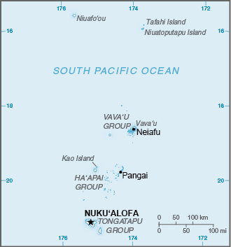 Map of Tonga
South of Samoa is an archipelago that is home to the Kingdom of Tonga. Only about 36 of the 169 islands are inhabited by a total population of about 106,000 people. Tonga is ruled by a monarchy that never lost its governance powers throughout the colonial era. Tonga is the only monarchy in the Pacific. The two main methods of gaining wealth are by remittances from citizens working abroad and tourism.
 The ula (dance) is an ancient Tongan group dance, already reported by early European navigators like Captain Cook.
Tuvalu
 Map of Tuvalu
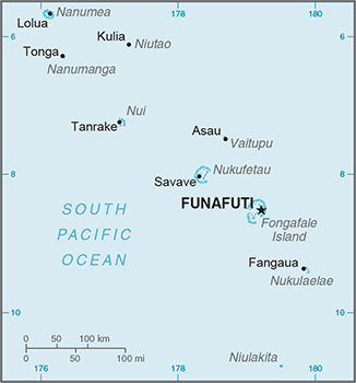
 The island nation of Tuvalu comprises four reef islands and five atolls for a total land area of about 10 square miles. In 2017, it had a population of about 11,000 people. These statistics indicate that Tuvalu is one of the four smallest countries in the world. Nauru is only about eight square miles in area. Only the Vatican and Monaco are smaller. The low elevation of the islands of Tuvalu make them susceptible to damage from rising sea levels. The highest point is only 15 feet in elevation. Any increase in ocean levels as a result of climate change could threaten the existence of this country.
French Polynesia
 Map of French Polynesia
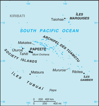
 The South Pacific is home to many islands and island groups that are not independent countries. The biggest and most significant group in the southern region is French Polynesia. France colonized a large number of islands in the South Pacific and has continued to hold them in its control or possession as external departments or colonies.
In western Polynesia, the French maintain control over the islands of Wallis and Futuna. French Polynesia consists of four main island groups: the Society Islands, the Austral Islands, the Tuamotu Islands, and the Marquesas. There are around 130 islands in French Polynesia, and many are too small or lack resources to be inhabited.
 The only ways to get to the islands are by aircraft or by ship. Transportation costs can be high for imported goods or for tourism development.
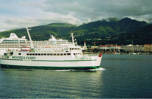
 Tahiti, located in the Society Islands, is the central hub of French Polynesia. Papeete is the capital and main city with a population of almost 30,000 people. Tahiti is a major tourist destination with a mild climate that stays at 75 °F to 85 °F year-round and receives adequate rainfall to sustain tropical forests. Most of the people live along the coastal areas. The interior is almost uninhabited. The Society Islands include the island of Bora Bora, which is considered by many to be a tropical paradise and one of the most exotic tourist destinations in the world.
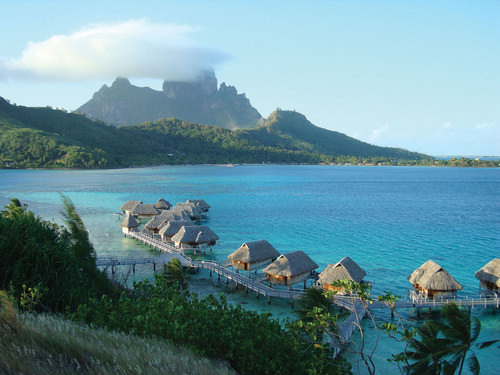 Bora Bora is a world-class tourist destination catering to the international traveler.
 The volcanic Marquesas Islands to the northeast are the second-most remote islands in the world after the Hawaiian Islands. The weather pattern in the Pacific does not bring enormous amounts of precipitation to the Marquesas, a reality that restricts human expansion in the archipelago. The higher elevations in the mountains—the highest is 4,035 feet—draw some precipitation from the rain shadow effect, giving rise to lush rain forests on portions of the islands.
With less than 10,000 people, the Marquesas do not have a large population to support and rely on financial support from outside to sustain them. French painter Paul Gauguin is buried there, and the islands are remembered as his home during the last years of his life.
The Austral Islands are the southernmost group of islands in French Polynesia and are home to only about 6,500 people. French Polynesia also includes the Tuamotu Archipelago, between the Society Islands and the Marquesas, which comprises about 75 atolls and an uncounted number of coral reefs that extend for about 900 miles. The islands have a population of fewer than 20,000 people. The main economic activity is the cultivation of black pearls and coconuts.
The French government used islands in the Tuamotu Archipelago as test sites for nuclear weapons. From 1966 to 1974, the French tested 41 atomic devices above ground in the atmosphere, and from 1974 to 1996, they tested 137 atomic devices below ground. Radiation concerns are the same here as they are on the Marshall Islands, where the United States tested atomic weapons.
Scientific testing monitored by the World Health Organization has determined the humans living closest to the atolls are not presently in danger of radioactive materials either in the environment or in their food supply. The long-term effects of underground tests continue to be monitored.
The Pitcairn Islands, Easter Island, and the Cook Islands
To the east of French Polynesia are the four Pitcairn Islands, controlled by Great Britain. The main island, Pitcairn, is the only inhabited island in this chain and is one of the least inhabited islands in the world; the total population is fewer than 50 people. Mutineers from the HMS Bounty escaped to Pitcairn in 1790 after taking various Tahitians with them.
Even farther east than Pitcairn, on the edge of Polynesia, is Easter Island. Now under the government of Chile, Easter Island was historically inhabited by Polynesians who built large stone heads that remain somewhat of a mystery. At the center of Polynesia are the 15 small Cook Islands, which are controlled by New Zealand and are home to about 20,000 people, many of whom claim Maori ethnicity.
- Melanesia includes the islands from Papua New Guinea to Fiji. Micronesia includes small islands located north of Melanesia. Polynesia includes island groups from the Hawaiian Islands to the Pitcairn Islands. Papua New Guinea is the largest country in the Pacific, approximately seven hundred languages are spoken by the many local groups that live there.
- Low islands in this region are usually composed of coral and low in elevation. High islands are usually volcanic in origin and mountainous with high elevations. Micronesia consists mainly of low islands, while Polynesia consists of many high islands, such as Hawaii.
- Tourism is the main economic activity in the Pacific, but minerals and fossil fuels provide some islands with additional wealth. Fishing and subsistence agriculture have been the traditional livelihoods. Offshore banking has also been established in the region.
- The United States, the United Kingdom, and France used various islands for nuclear testing. Radiation fallout continues to be an environmental concern. Typhoons, tsunamis, volcanic activity, earthquakes, and flooding create devastation on the islands. Fresh water can be a valuable resource, as it is in short supply on many islands.
Vocabulary Terms
|
archipelago |
A series of groups of island chains |
|
atoll |
A ring-like coral island or string of small islands surrounding a lagoon |
|
Bikini Atoll |
The isolated reef, located in the Marshall Islands of the Central Pacific, that was the site of US nuclear bomb tests, consequently contaminating the atoll with high levels or radiation and riving its inhabitants away |
|
Guadalcanal |
Principal island in the Solomon Islands that was the sight of vicious fighting between the American's and Japanese during WWII |
|
high islands |
these islands are generally young, homogenous, multiple (altitudinal) environmental zones. Poor in some resources (rock). Many have wet (windward) and dry (leeward) sides with distinct environments |
|
Liliuokalani |
The queen and last sovereign ruler of Hawaii until it was annexed by the United States |
|
low islands |
Pacific islands made out of coral reefs |
|
Melanesia |
A region in Oceania means "black island" |
|
Micronesia |
One of three regions in Oceania, meaning "tiny islands" |
|
Oceania |
The group of islands in the Pacific, including Melanesia, Micronesia, and Polynesia |
|
ozone depletion |
The wearing out or reduction of the earth's Ozone or Stratosphere |
|
Polynesia |
Islands of the central and southern Pacific |
Applying Knowledge
Interactive Notebook Activities
- List the three main areas of the South Pacific.
- Explain the difference between low islands and high islands.
- List which islands remain under the control of France, the United Kingdom, New Zealand, or the United States.
- Describe the primary economic activities of the islands in the realm.
- Summarize the main environmental concerns of the islands in each region.
Discussion and Study Questions
- What are the three main regions of islands in the Pacific? What island nations belong to each?
- What are the traditional methods of making a living on the Pacific islands?
- What is the difference between a low island and a high island? Give examples of each.
- Why are so many islands in the Pacific governed by the United States?
- Name three major environmental concerns of these islands.
- What has been a growing sector of the economy for many of the Pacific islands?
- Which island group is the largest protected environmental marine habitat in the world?
- What islands did the United States, Great Britain, and France use for testing nuclear weapons?
- On which island are more than seven hundred separate languages spoken? Why are so many languages spoken?
- What main factors have determined the economic activities of the Pacific?
Real-World Geography Exercise
- Using Google Maps, complete the following activities:
- Locate each place on the bulleted list below.
- Find the nearest city with an international airport in proximity to each location on the bulleted list below.
- Calculate the distance and travel time by plane to each city from the Daniel K. Inouye International Airport in Honolulu, Hawaii.
- Using NASA Latitude and Longitude Finder, determine the latitude and longitude for each location on the bulleted list below.
- Be prepared to share and discuss your answers.
- American Samoa
- Austral Islands
- Bora Bora
- Cook Islands
- Easter Island
- Fiji
- French Polynesia
- Gilbert Islands
- Guadalcanal
- Guam
- Hawaiian Islands
- Kiribati
- Marquesas
- Marshall Islands
- Melanesia
- Micronesia
- Nauru
- Northern Mariana Islands
- Palau
- Papua New Guinea
- Pitcairn Islands
- Polynesia
- Samoa
- Society Islands
- Solomon Islands
- Tahiti
- Tonga
- Tuamotu Islands
- Tuvalu
- Vanuatu
- Wake Island
- Western Samoa
Current Events
5 Reasons Why Educational Laptops Were Doomed in Papua New Guinea
Tree-Dwelling, Coconut-Cracking Giant Rat Discovered In Solomon Islands
Dengue In Vanuatu: More Than 200 Cases In 2019 To Date
New Caledonian Crows Smart Enough To Plan Three Steps Ahead To Solve Tricky Problem
Micronesian Culture Is Part Of My American Culture
Tiny Pacific Island Finds Itself In The Crosshairs Of North Korea. Why Guam?
Aerial Photos Show WWII Wrecks In Watery Graves Off Remote Pacific Ocean Tropical Islands
Lawmaker in Island Nation of Nauru Wants To Make It Illegal To Be Gay—Again: VIDEO
Sea Level Rise Is Already Driving People From The Marshall Islands
New Research Predicts The Future Of Coral Reefs Under Climate Change
Videos for Geography Enrichment
Helpful Websites for the Study of Geography
Canadian Encyclopedia is an encyclopedia funded by the Canadian government covering all branches of knowledge. Their scholarly collection includes interactive materials.
CIA World Factbook provides information on the people, history, government, economy, energy, geography, communications, transportation, military, and transnational issues for the world's entities.
Congress.gov is a US government website where you can find federal legislation, past and present, as well as information about the US legal system.
Drug Enforcement Administration (DEA) is a government agency website that provides current news, resources, topics of interest, information about drugs, careers in the DEA, and a tip hotline.
Library of Congress is the largest library in the world and provides manuscripts, files, information, pictures, and videos.
NASA Earth Observatory (NEO) is a US government agency website that allows users to search for and retrieve satellite images of Earth.
National Archives is a US government website that provides historical documents, photos, records, publications, and educator resources.
National Oceanic and Atmospheric Association (NOAA) is a US government agency website that provides weather-related information and ocean research.
National Map is a website by the United States Geological Survey and other federal, state, and local agencies that delivers topographic information for the United States.
NationMaster is a massive central data source and a handy way to graphically compare nations.
Real-Time World Air Quality Index is a website that measures most locations in the world for air pollution in real time.
StateMaster is a unique statistical database which allows you to research and compare a multitude of different data on US states.
United Nations (UN) is an international organization founded in 1945 and made up of 193 member states. The UN maintains international peace and security, protects human rights, delivers humanitarian aid, promotes sustainable development, and upholds international law.
United States Census Bureau is a US government agency that provides a population clock, data, surveys, statistics, a library with information and infographics, news about the economy, and much more.
United States Geological Survey (USGS) is a US government agency website that provides scientific information about the natural hazards that threaten lives, the natural resources we rely on, the health of our ecosystems and environment, and the impacts of climate and land-use change.
Whitehouse.gov is a US government website that provides the latest presidential news, information about the budget, policy, defense, and many more topics.
World Health Organization (WHO) is under the United Nations and provides leadership on matters critical to health, shapes the research agenda on health, and monitors the health situation and assessing health trends around the world. Their website provides information on the state of health around the world, outbreaks, current health news, and more.
World Trade Organization (WTO) is an intergovernmental organization that regulates international trade. The website provides information on the history of the multilateral trading system, featured videos, news and events, trade topics, and more.
